
I’m happy to share my newest publication on combining Sentinel-1 SAR data with deep learning and change vector analysis for quantifying erosion rates of Arctic permafrost coasts in the open access journal Remote Sensing by MDPI together with my co-authors Andreas Dietz, Tobias Ullmann and Claudia Künzer.

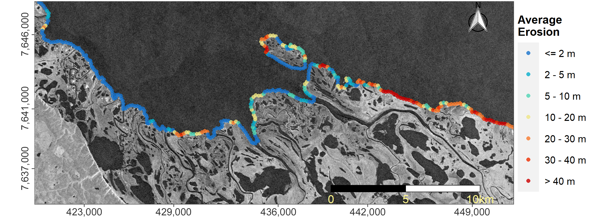
From the Abstract: Arctic permafrost coasts become increasingly vulnerable due to environmental drivers such as the reduced sea-ice extent and duration as well as the thawing of permafrost itself. A continuous quantification of the erosion process on large to circum-Arctic scales is required to fully assess the extent and understand the consequences of eroding permafrost coastlines. This study presents a novel approach to quantify annual Arctic coastal erosion and build-up rates based on Sentinel-1 (S1) Synthetic Aperture RADAR (SAR) backscatter data, in combination with Deep Learning (DL) and Change Vector Analysis (CVA). The methodology includes the generation of a high-quality Arctic coastline product via DL, which acted as a reference for quantifying coastal erosion and build-up rates from annual median and standard deviation (sd) backscatter images via CVA. The analysis was applied on ten test sites distributed across the Arctic and covering about 1038 km of coastline. Results revealed maximum erosion rates of up to 160 m for some areas and an average erosion rate of 4.37 m across all test sites within a three-year temporal window from 2017 to 2020. The observed erosion rates within the framework of this study agree with findings published in the previous literature. The proposed methods and data can be applied on large scales and, prospectively, even for the entire Arctic. The generated products may be used for quantifying the loss of frozen ground, estimating the release of stored organic material, and can act as a basis for further related studies in Arctic coastal environments.
Full Article: Philipp, M.; Dietz, A.; Ullmann, T.; Kuenzer, C. Automated Extraction of Annual Erosion Rates for Arctic Permafrost Coasts Using Sentinel-1, Deep Learning, and Change Vector Analysis. Remote Sens. 2022, 14, 3656. https://doi.org/10.3390/rs14153656