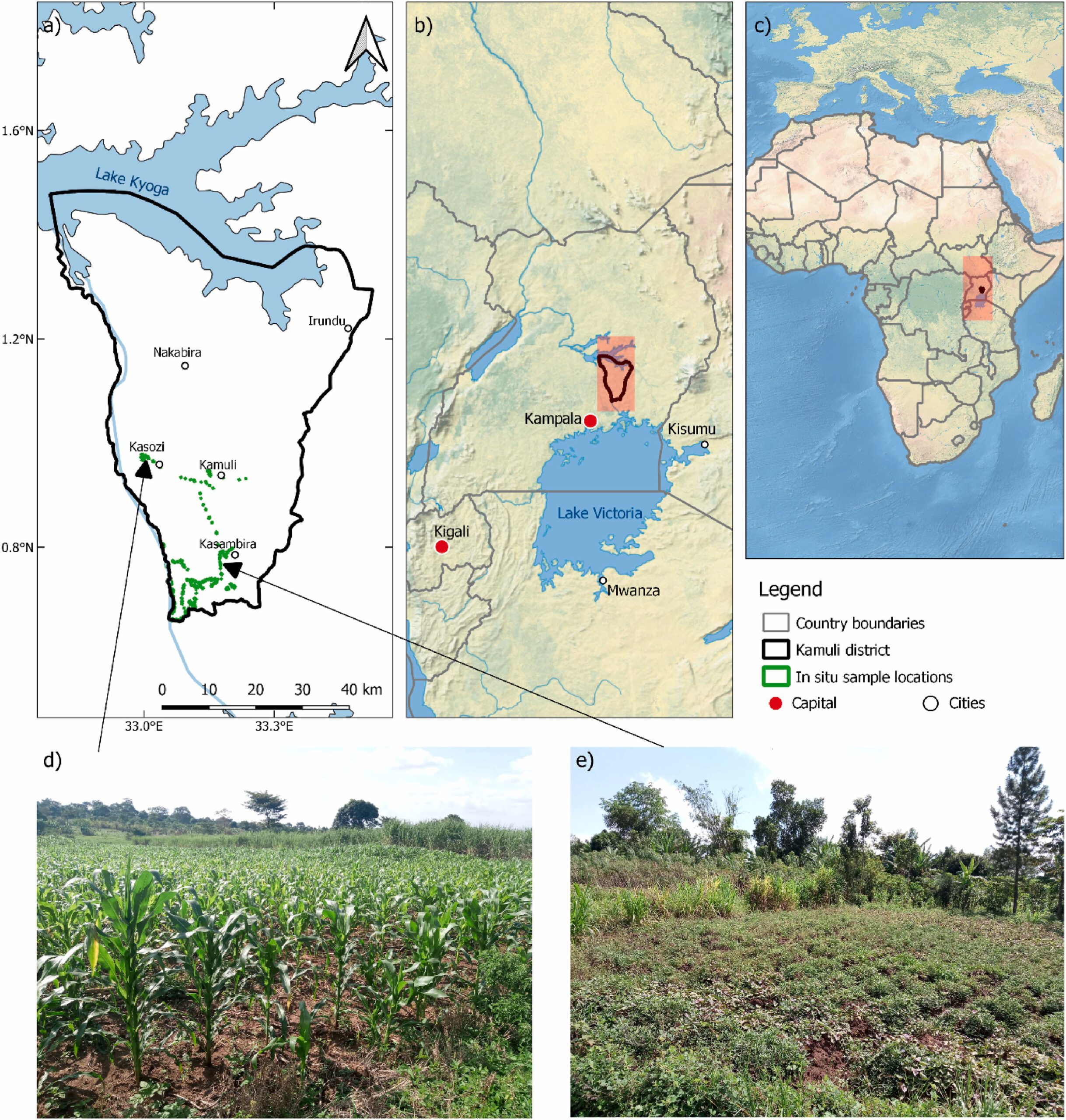
The paper titled “Harmonized NDVI time-series from Landsat and Sentinel-2 reveal phenological patterns of diverse, small-scale cropping systems in East Africa” was just published in the journal Remote Sensing Applications: Society and Environment by our team at the Earth Observation Research Cluster (Adomas Liepa, Tobias Ullmann, Michael Thiel, Hannes Taubenböck, Itohan-Osa Abu, Maninder Singh Dhillon and Insa Otte) along with our colleagues from Project UPSCALE (https://upscale-h2020.eu/) (Ingolf Steffan-Dewenter, Michael Hilary Otim, Moses Luttakome, David Meinhof and Emily A. Poppenborg Martin). This work was supported by the European Commission within the HORIZON2020 programme [grant number 861998].
Here is the abstract of the paper: Capturing the phenological responses of crops in diverse, small-scale agricultural systems is one of the most notable remote sensing research gaps in Eastern Africa. Because of the heterogeneous and complex agricultural environments, remote sensing methodologies successfully implemented elsewhere yield poor results in Eastern Africa. The reliance on local rainfall and dry spells can lead to alterations in planting patterns, impacting growing season timing and yield, underscoring the importance of high temporal resolution for capturing crop phenology. We generated a high-resolution land use/land cover (LULC) classification map of 10 m using Sentinel-1 and Sentinel-2 imagery together with a large set of reference data acquired in situ in 2022. The LULC classification yielded an overall accuracy of 87.9% and Cohen’s kappa value of 0.83. Based on the LULC map, we investigated the phenological metrics of the most important crops in the Kamuli district of Eastern Uganda by combining a multi-sensor harmonization approach, thresholding method, and cloud computing. Previously unavailable Landsat 9 band adjustment coefficients were derived. By harmonizing Landsat (LS) 7 Enhanced Thematic Mapper Plus (ETM+), Landsat 8 and 9 Operational Land Imager (OLI), with Sentinel-2 Multispectral Instrument (MSI), the phenological patterns during the March to May growing season were captured using a dense temporal Normalized Difference Vegetation Index (NDVI) time series. The seasonal onset for most crop types was in the end of March to middle of April while the end of the growing season occurred from the end of June to middle of July. Investigation of the 13 crop types using a high-resolution LULC map and dense, harmonized NDVI time series signifies the first field-level phenological metrics estimation of smallholder farming systems in Eastern Africa. Future research should focus on expanding the methodology in space and time to provide insights into past and current growing season development.
Find the link to the full paper here: https://www.sciencedirect.com/science/article/pii/S2352938524000946?via%3Dihub

