
At the EORC we deploy a range of space-borne and UAS-based sensors for environmental research. While many systems come with established calibration procedures, some of our UAS sensors require dedicated validation and characterization to ensure scientifically reliable measurements. This is particularly true for our thermal UAS sensor, for which standard calibration approaches are not readily applicable. In such cases, detailed sensor characterization becomes essential.
In a recent study linked to our ongoing work on mapping thermal signatures across different ecosystems, our staff members Antonio Castañeda Gomez and Luisa Pflumm, together with their MSc student Anna Bischof and EAGLE MSc students Lukas Fronzeck and Sebastian Rothaug, conducted a comprehensive geometric calibration analysis of the thermal sensor.
Thermal cameras are often assessed primarily in terms of radiometric performance. However, geometric behavior is equally important when spatial accuracy and comparability over time are required. In our applications, this is especially critical because we operate three thermal sensors simultaneously with non-nadir viewing geometries. A clear understanding of the geometric properties is therefore necessary for reliable multi-angle data integration. The team focused on determining whether the sensor can be geometrically corrected with sufficient precision, or alternatively, how its inherent geometric accuracy should be quantified and documented.
The study addressed several key aspects:
-
geometric calibration and distortion behavior
-
effective spatial resolution of the thermal imagery
-
positional accuracy under operational flight conditions
-
discrimination potential of thermal features
-
effects of varying viewing angles on image geometry
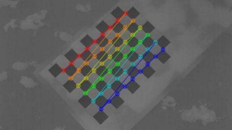
Field experiments were designed to capture controlled test patterns from multiple perspectives. By comparing measured positions and thermal signatures against known reference targets, the team evaluated how image geometry changes with flight altitude and sensor orientation. Particular attention was given to the trade-off between spatial resolution and geometric accuracy, a balance that is especially relevant in low-altitude UAS operations.
The results provide an important foundation for interpreting thermal datasets acquired by our platform. They help define the practical limits of geometric correction and clarify the conditions under which the sensor can reliably resolve small thermal contrasts. This knowledge feeds directly into ongoing environmental monitoring projects and improves the reproducibility of future campaigns.
Beyond the technical outcomes, the project highlights the collaborative nature of our work. Staff and students contributed jointly to experimental design, data acquisition, and analysis, reflecting the EORC’s emphasis on hands-on research training and interdisciplinary teamwork.