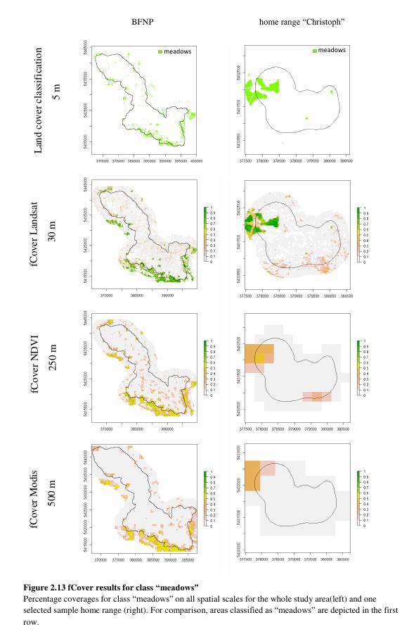
 Sophia Wisboeck handed in her BSc thesis “Explaining variation in home range size of red deer (cervus elaphus) in the Bavarian Forest National Park using LiDAR derived metrics on forest structure and fractional cover”. Her analysis of fractional cover and Lidar to explain home range sizes of red deer was very interesting and she gained valuable insights. Please read her abstract if you are interested: Effective conservation strategies and management are crucial to protect animals in their natural environment and provide them with the space and resources they need. However, further ecological research on animal behavior and habitat use is indispensable to provide a profound basis for such management decisions. One important issue hereof is understanding species’ spatial behavior, especially the use of home ranges which are defined by „that area traversed by the individual in its normal activities of food gathering, mating, and caring for young“ (Burt 1943). In general, home range selection can be summarized as trade-off between food availability and shelter. However, for ungulate species, home ranges are often found to vary substantially in size. The objective of this thesis is to analyze home range data of red deer (cervus elaphus) in the Bavarian Forest National Park and find possible explanations for their variation in size. Home ranges of five red deer individuals have been detected using GPS collars and serve as basis for the analysis. Information on forest structure derived from airborne LiDAR remote sensing, i. e. forest density in different height strata and canopy height metrics are related to the differing sizes of the home ranges. Furthermore, the use of fractional cover (fCover), a continuous land cover estimation method, to explain home range size is investigated. Analysis is carried out by fitting linear models. Results reveal that fCover is a promising method to predict variation in home range size, whereby it appears that with higher spatial resolution its predictive potential increases. LiDAR, in contrast, is not proved suitable for explaining variation in home range size under the circumstances given in this thesis.
supervised by Martin Wegmann, data provided by Benjamin Leunter and Mirjana Bevanda via the NP Bavarian Forest