MSc defense (MA2) by Ása Dögg Adalsteinsdóttir
On Monday, September 18, 2023 Ása Dögg Adalsteinsdóttir will present her Msc Thesis at 14:00
Detection of slope deformation at the Tröllaskagi peninsula, N-Iceland, using Sentinel-1 DInSAR time series
Thema: MSC Colloquium
Uhrzeit: 18.Sept. 2023 13:00 Amsterdam, Berlin, Rom, Stockholm, Wien
From the abstract:
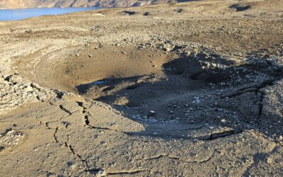
Following the last deglaciation, glacially eroded hillslopes of the Tröllaskagi peninsula in northern Iceland experienced intensive rockslide activity. In the Almenningar site, located on the outermost part of the peninsula, several rockslide features show active surface displacement, which has repeatedly caused major damages and hazardous conditions to a road that crosses the area. Since 1977, the Icelandic Road and Coastal Administration (IRCA) has maintained regular measurements and, in 2022, GNSS stations were installed for real-time monitoring. These measurements indicate deformation rates up to 70 cm per year. Monitoring results further suggest a relationship between deformation and hydroclimatological factors. Furthermore, the front of the deformation area reaches the coast forming up to 60 m high cliffs where clear indications of extensive coastal erosion can be found. Whereas traditional landslide monitoring and field measurements can be expensive and time-consuming, remote sensing methods such as satellite Differential Interferometric Synthetic Aperture Radar (DInSAR) time series analysis has proven to be a valuable tool for large-scale slope deformation detection. In this study, we implement the multi-temporal, small-baseline DInSAR method using MintPy software and workflow, decreasing limiting factors like atmospheric delay, orbital errors and decorrelation. We use the Copernicus Sentinel-1 SAR satellite constellation with its 6 day (since 2022: 12 day) revisit time over Iceland. The displacement time series was generated for the summers of 2019 through 2022 to (i) detect the spatio-temporal slope deformation patterns in the three landslides of Almenningar: Tjarnadalir, Þúfnavellir and Hraun (ii) analyse if these landforms have similar deformation response to hydroclimatological conditions and/or seismic episodes and (iii) analyse the suitability of using DInSAR time series for deformation detection in Almenningar. The results indicate active deformation rates in two of the three landslides. Additionally, areas of increased velocity within the landslides are detected. Response to the external factors is detected in the time series as either loss of coherence or deformation signal. Finally, although with its limitation, the area is considered quite suitable for deformation monitoring using DInSAR. In conclusion, DInSAR provides useful information to analyse rockslide features in Tröllaskagi and correlate detected deformation to hydroclimatological conditions and seismic episodes. The results will serve as an important support for hazard and risk assessment and contribute to further research on triggering factors.
1st supervisor MSc:
Prof. Dr. Tobias Ullmann
2nd supervisor MSc:
Þorsteinn Sæmundsson, University of Iceland