High alpine and snow training

High alpine and snow training

m

February 23, 2024

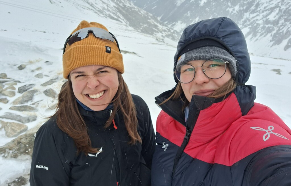
In collaboration with the German Alpine Club (DAV), Laura, one of our EAGLE students and Clara, a student assistant at our institute, recently participated in avalanche rescue training aimed at equipping individuals with essential skills and knowledge to respond effectively to avalanche emergencies in mountain areas. Throughout the training, we engaged in basic exercises using avalanche safety equipment. The minimal snow cover at Spitzingsee transformed the experience into a unique adventure reminiscent of geocaching. The training commenced with foundational exercises utilizing avalanche beacons, probes, and shovels. Despite the limited snow cover, we diligently practiced search and rescue techniques, honing our abilities to locate buried beacons and simulate rescue scenarios. Indulging in delectable Kaiserschmarrn—a traditional Austrian dessert—enhanced their culinary experience, while the overnight stay in Albert-Link Hütte offered a glimpse into the rustic charm of mountain living.

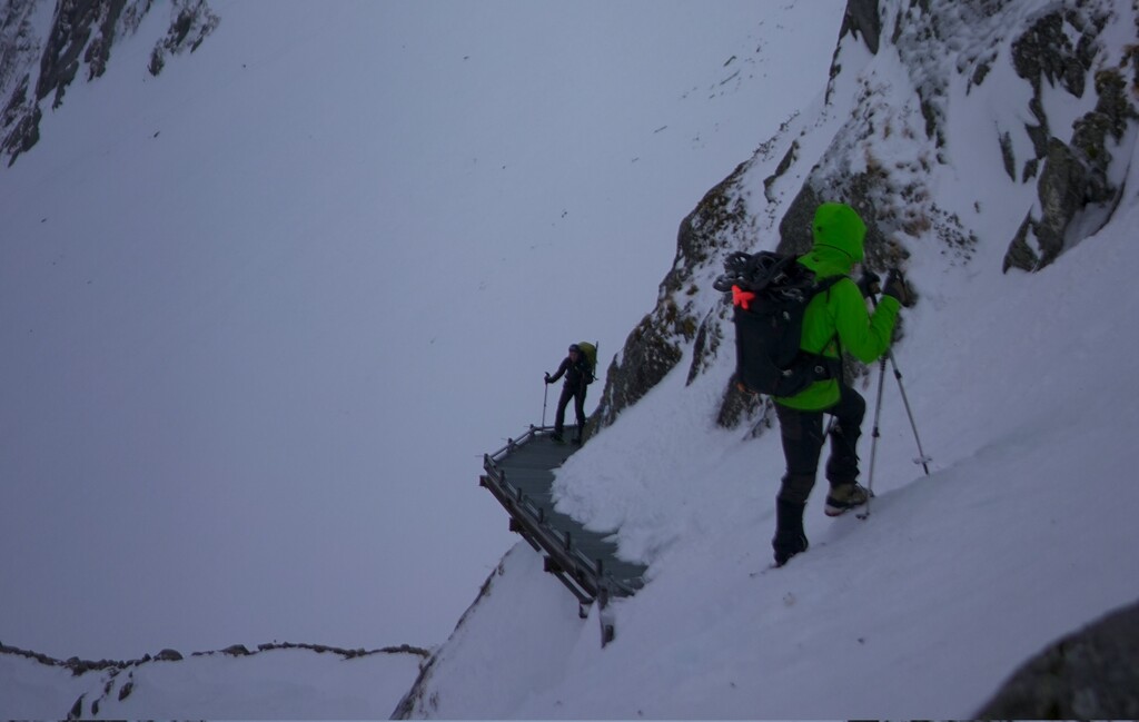
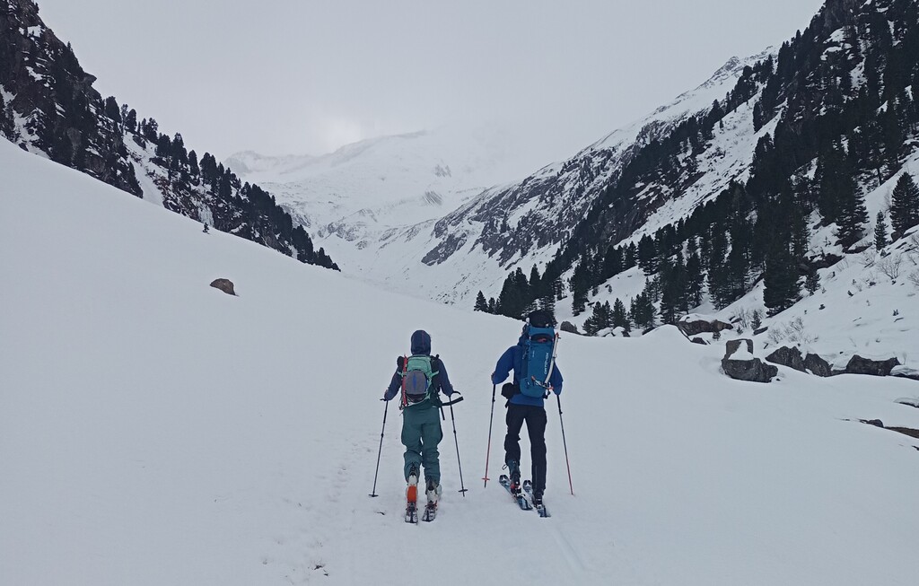
Having completed the training, they were eager to apply their newfound skills in a real-world setting the next day. A snowshoe/ski tour to Zittauer Hütte in Zillertal, Austria, proved to be a worthy destination to this end. The approach was challenging, with strong winds, icy trails and whiteout conditions. Therefore, they decided not to climb Wildkarspitze. Against this backdrop, they traversed the terrain with enthusiasm, relishing the beauty of the alpine wilderness. Fortunately, the winter chamber of the Zittauer hut was equipped with enough wood to heat the old stove, providing them with tea from melted snow, a hot noodle soup and a night of good sleep. This outdoor excursion served as a fitting conclusion to our training experience, reinforcing the importance of preparedness and safety in mountain environments.

Reflecting on the training experience, Laura emerged with a heightened sense of confidence and proficiency in avalanche rescue procedures. The training underscored the significance of ongoing education and preparedness in mitigating avalanche hazards.

follow us and share it on:

you may also like:

Starkregen in Bayern: Beobachtungen und Dokumentation zählen

Starkregen in Bayern: Beobachtungen und Dokumentation zählen

Starkregenereignisse treten immer häufiger lokal, kurzfristig und mit hoher Intensität auf. Innerhalb weniger Stunden können sie erhebliche Überschwemmungen und Schäden verursachen. Um solche Ereignisse künftig besser zu verstehen und die wissenschaftliche Grundlage...

Seeing the World in Points: Lidar Course for the EAGLEs

Seeing the World in Points: Lidar Course for the EAGLEs

Lidar has a funny way of sneaking up on you. You think you know what it is, a laser that measures distance, fine, but then someone shows you a point cloud of a forest canopy with individual branches floating in 3D space and suddenly you realize there's a whole...

RTL covers EORC: TV Crew Films MONID Habitrack Fieldwork

RTL covers EORC: TV Crew Films MONID Habitrack Fieldwork

A bit of extra excitement at EORC recently, an RTL television crew showed up to film a segment on the MONID Habitrack project, and Dr. Ariane Droin was right in the middle of it, walking them through what Earth Observation actually brings to the table for a project...

Ticks from Above: UAS Fieldwork for the MONID Habitrack Project

Ticks from Above: UAS Fieldwork for the MONID Habitrack Project

Forest edges are tricky places. They're where woodland meets open ground, where light and shade trade off every few meters, and where, it turns out, ticks tend to do really well. That last bit is exactly why Dr. Ariane Droin, Sofica Garcia de Leon, Dr. Jakob...

Course on urban EO by Michael Wurm

Course on urban EO by Michael Wurm

Walk through any city and you pick up on things that are hard to put a number on. The noise of a main road, the heat that sits between buildings in summer, the question of whether that little park around the corner is really enough green space for the whole...

EireR R package: unified gateway to Irish geospatial data

EireR R package: unified gateway to Irish geospatial data

Anyone who's tried to do geospatial work across the whole island of Ireland knows the headache. Ireland is one island geographically, but it's split across two jurisdictions, the Republic and Northern Ireland, and each one runs its own data infrastructure. Different...

Share This