Innolab presentation: Deep Learning-driven Image Super-Resolution for TerraSAR-X

Innolab presentation: Deep Learning-driven Image Super-Resolution for TerraSAR-X

m

October 22, 2024

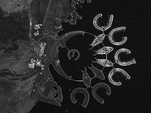
On November 05, 2024, Jannik Hoffmann will present his InnoLab results on ” Deep Learning-driven Image Super-Resolution for TerraSAR-X” at 12:00 in seminar room 3, John-Skilton-Str. 4a.
From the abstract: High-resolution satellite Synthetic Aperture Radar (SAR) data is crucial in many application areas such as defence, urban and infrastructure monitoring, disaster response, or business intelligence solutions. However, those are currently limited by high costs and technical compromises between image resolution and coverage area. This project employs cutting-edge artificial intelligence to enhance the resolution of SAR images to provide affordable high-resolution data with wide coverage. The objectives of the Innovation Lab within the Geo-Intelligence division at Airbus included various preprocessing tasks of Terra-SAR-X Radar data and the development, training and evaluation of a super-resolution model adapted to the acquired data.
Supervisor: Prof. Dr. Tobias Ullmann
Hosting Institution: Airbus Defence and Space

you may also like:

Project meeting NetCDA

Project meeting NetCDA

The first annual NetCDA project meeting took place in Würzburg on November 21st, 2024. Together with all German and West African partners from the West African Science Service Centre on Climate Change and Land Use (WASCAL), we have laid the foundation for our future...

The EORC can also be found on bluesky

The EORC can also be found on bluesky

We are active on various social media channels but in the last weeks we monitored a very strong increase of scientists joining bluesky and following our activities on that platform. Therefore we decided to be more active on bluesky and post regular news about our...

Blender GIS introduction

Blender GIS introduction

Within out EAGLE Earth Observation M.Sc. we also cover software applications which might not be used on a regular basis within our field of research but are sometimes highly useful to display our spatial data in a visually appealing way - and also potentially provides...

EAGLE presentation by Gökçe Yağmur Budak

EAGLE presentation by Gökçe Yağmur Budak

On November 26, 2024, Gökçe Yağmur Budak will present her internship results on " Leveraging Data-Driven Approaches for Seismic Risk Assessment in Istanbul " at 12:30 in seminar room 3, John-Skilton-Str. 4a. From the abstract: This internship aims to create time...

JURSE – deadline for paper submission extended

JURSE – deadline for paper submission extended

JURSE - Joint Urban Remote Sensing Event   The 17th International Conference on Joint Urban Remote Sensing (JURSE), organized by Higher School of Communication of Tunis (SUP'COM) will take place in Tunisia from 4 to 7 May 2025. https://2025.ieee-jurse.org/ ;...