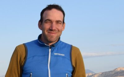


Thilo is the person at EORC who can tell you exactly how much air pollution was hanging over a given megacity in any given year since the 1990s, and what that actually meant for the people living there. He teaches atmospheric composition and urban remote sensing at EAGLE, and his research is basically the foundation the course content is built on.
He has spent over 25 years working as an Earth Observation scientist at DLR, with air quality, urban climate, and environmental health as a constant thread running through all of it. Thilo works at the intersection of satellite remote sensing, atmospheric science, and environmental epidemiology, turning EO data into air-quality and health-risk assessments that inform policy and climate adaptation. He connects what we can observe from space with what matters on the ground: cleaner air, more resilient cities, and healthier people.
His current research spans the atmospheric footprints of urbanization, economic activity, and policy interventions, as well as disruptive events such as wildfires and armed conflicts; extreme heat as a compound risk; and EO-informed urban climate modelling for planning and adaptation. He moves between continental-scale satellite swaths and street-level pollution or heat hotspots, always keeping the human dimension in view. That range is what makes his teaching especially valuable. In his EAGLE courses, Thilo brings satellite data, numerical modelling, and real-world case studies together to show how Earth observation helps us understand air pollution, heat exposure, and environmental risk. Remote sensing can sometimes focus heavily on land cover and built structures; Thilo makes sure the invisible but consequential layer is not left out of the picture.
His PhD in geography at the University of Würzburg pulled many of these threads together. It examined satellite-based NO₂ pollution at scales ranging from global down to urban, using NO₂ as a proxy for air quality and human activity, since it doesn’t linger long in the atmosphere and is almost entirely anthropogenic. One study tracked global megacities from 1996 to 2015 and found income-related differences in how pollution tracks urban growth, consistent with the Environmental Kuznets Curve: pollution climbs as income rises, then falls again once economies get wealthier and cleaner tech kicks in. Another zoomed into Germany at high resolution and tied NO₂ hotspots to urban density, power plants, and road infrastructure. Specific, sure, but the approach is broad: move between scales, keep people in view, turn signals into evidence. Students also get to see how this works behind the scenes, visiting DLR-EOC in Oberpfaffenhofen to learn how air pollution and urban climate monitoring operate in practice. For students asking how Earth observation plugs into environmental policy and public health, Thilo offers something rare: first-hand insight from someone who has spent nearly three decades doing exactly that work.