Meeting with the LfU Augsburg on nature conservation applications in the EO4CAM project

Meeting with the LfU Augsburg on nature conservation applications in the EO4CAM project

April 29, 2025

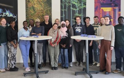
On April 28, 2025, a working meeting was held with the State Office for the Environment (LfU) in Augsburg as part of the EO4CAM project, attended by project team members from the German Aerospace Center (DLR) and the University of Würzburg. The focus was on the possibilities of remote sensing to support biotope networks and biotope mapping, i.e., to record trees, woody structures, orchards, and small-scale biotopes in open land and urban areas. There is particular interest here in the recording of linear woody features, rows of trees and avenues, orchard,s and urban trees using satellite and aerial image data. The participants discussed methods for improving data accuracy and possible application scenarios in nature conservation. As a potential user of the data products developed in the EO4CAM project, the LfU supports the optimization of the applications with valuable technical expertise and by providing definitions and data to promote the conservation of valuable habitats.


Treffen mit dem LfU Augsburg zu Naturschutzanwendungen im Projekt EO4CAM

Am 28. April 2025 fand im Rahmen des Projekts EO4CAM ein Arbeitstreffen mit dem Landesamt für Umwelt (LfU) in Augsburg statt, an dem Mitarbeitende des Deutschen Zentrums für Luft- und Raumfahrt (DLR) und der Universität Würzburg teilnahmen. Im Fokus standen die Möglichkeiten der Fernerkundung zur Unterstützung von Biotopverbund und Biotopkartierung, also zur Erfassung von Bäumen, Gehölzstrukturen, Streuobstwiesen und kleinflächigen Biotopen im Offenland und urbanen Raum. Besonderes Interesse besteht hier an der Erfassung linearer Gehölze, Baumreihen und Alleen, Streuobst- und Stadtbäumen mittels Satelliten- und Luftbilddaten. Die Teilnehmenden diskutierten Methoden zur Verbesserung der Datengenauigkeit sowie mögliche Einsatzszenarien im Naturschutz. Als potenzieller Nutzer der im Projekt EO4CAM entwickelten Datenprodukte unterstützt das LfU die Optimierung der Anwendungen durch wertvolle fachliche Expertise sowie durch die Bereitstellung von Definitionen und Daten, um so den Erhalt wertvoller Lebensräume zu fördern.

you may also like:

New study on invasive species in Rwanda

New study on invasive species in Rwanda

A new publication by EORC members Lilly Schell, Insa Otte, Sarah Schönbrodt-Stitt and Konstantin Müller, was just published   in the Journal Frontiers in Plant Science. Their study, “Synergistic use of satellite, legacy, and in situ data to predict spatio-temporal...

Poster Presentations at the GfÖ-Conference in Würzburg

Poster Presentations at the GfÖ-Conference in Würzburg

Being part of the organizers of this year's GfÖ-Conference in Würzburg our staff members Sonja Maas, Jakob Schwalb-Willmann and Maninder Singh Dhillon were happy to present the posters on their research topics today. The annual meeting of the GfÖ (Society for Ecology)...

Bridging Scales: How Radar Satellites supports Crop Monitoring

Bridging Scales: How Radar Satellites supports Crop Monitoring

In an era of climate uncertainty and increasing pressure on agricultural systems, understanding how crops grow and respond to environmental stress is more important than ever. A new study led by researchers from Martin-Luther-University Halle-Wittenberg, in close...

Upcoming PhD Defense by Ariane Droin

Upcoming PhD Defense by Ariane Droin

Ariane Droin will defend her PhD thesis "Permeabilität und Erreichbarkeit lokaler Nachbarschaften im urbanen Kontext. Eine geographische Analyse auf Basis räumlicher Netzwerke." on September 16th at 4 p.m. at the John-Skilton Straße 4a, Seminar Room 2/00.B.03.  ...

PhD Defense by Dorothee Stiller

PhD Defense by Dorothee Stiller

Dorothee Stiller will defend her PhD thesis "Potential of Remote Sensing Data and Methods for Urban Transport Research" on 15th of September at 4 p.m. at the John-Skilton Straße 4a, seminar Room 2/00.B.03. Everyone who is interested is cordially invited to join her...

Strengthening Collaboration with SANParks for Conservation Research

Strengthening Collaboration with SANParks for Conservation Research

Our long-standing collaboration with Dr. Corli Coetsee and Dr. Ben Wigley from SANParks is moving forward with promising new research activities. The joint work is focusing on mapping savanna features more accurately such as trees, paths, or animals through innovative...