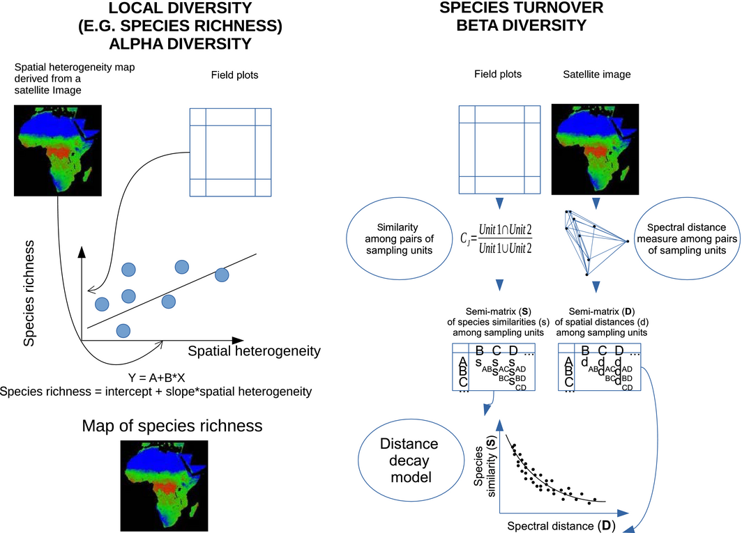
 a new article just got published on monitoring species diversity from satellite remote sensing highlighting the potential and pitfalls. Assessing the level of diversity in plant communities from field-based data is difficult for a number of practical reasons: (1) establishing the number of sampling units to be investigated can be difficult; (2) the choice of sample design can impact on results; and (3) defining the population of concern can be challenging. Satellite remote sensing (SRS) is one of the most cost-effective approaches to identify biodiversity hotspots and predict changes in species composition. This is because, in contrast to field-based methods, it allows for complete spatial coverages of the Earth’s surface under study over a short period of time. Furthermore, SRS provides repeated measures, thus making it possible to study temporal changes in biodiversity. Here, we provide a concise review of the potential of satellites to help track changes in plant species diversity, and provide, for the first time, an overview of the potential pitfalls associated with the misuse of satellite imagery to predict species diversity. Our work shows that, while the assessment of alpha-diversity is relatively straightforward, calculation of beta-diversity (variation in species composition between adjacent locations) is challenging, making it difficult to reliably estimate gamma-diversity (total diversity at the landscape or regional level). We conclude that an increased collaboration between the remote sensing and biodiversity communities is needed in order to properly address future challenges and developments.