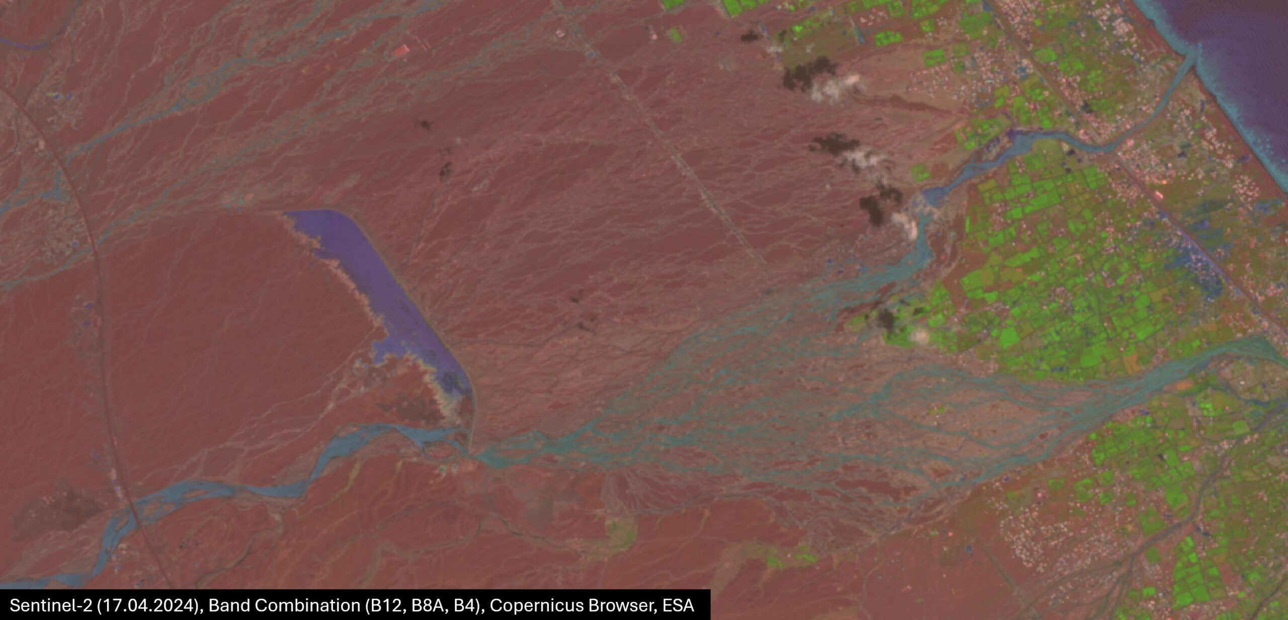
New Collection in the Springer Nature journal “Discover Geoscience” with guest editors Florian Betz und Tobias Ullmann

New Collection in the Springer Nature journal “Discover Geoscience” with guest editors Florian Betz und Tobias Ullmann

m

June 13, 2024

Description:

Arid and semi-arid regions cover about 40% of the world’s land and host over 30% of its population, making them vital and vulnerable. Drylands are expanding, with significant water shortage in large basins due to climate change, while at the same time devasting flash floods have occurred recently. Despite their climatic extremes and strong response to climate fluctuations, their sensitivity and reaction times are not well understood. Better knowledge of dryland development and dynamics under climate change supports preservation of ecosystems and boosts resilience.

This collection focuses on dynamic fluvial systems of arid and semiarid regions, asking for new techniques and interdisciplinary approaches to address key issues and advancements in these environments in face of climate change. The contributions within this collection emphasize the role of geoscience, remote sensing and earth observation technologies in monitoring, modelling and/or analyzing rapid or long-term environmental changes and patterns in arid fluvial landscapes, offering new insights into their unique characteristics, complex interactions, and the challenges they face.

Submissions may focus, but are not limited to, the structure, function, and management of flash floods, riverine and riparian environments, providing insights into their critical role in supporting life and sustaining natural processes in arid areas. Additionally, the collection welcomes studies on bio-geomorphology and geomorphology, which delve into the interactions between biological processes and landforms, e.g. on how these relationships shape the landscape over time, revealing the dynamic interplay between living organisms and their physical environment.

Keywords:

remote sensing; hydrological modelling; flash floods; semiarid; arid; river systems; biogeomorphology; geomorphology; earth observation; riparian systems; climate change,


Links and further reading:

https://link.springer.com/journal/44288

https://link.springer.com/collections/gbijgfajgf?utm_medium=email&utm_source=generic&utm_content=null&utm_term=null&utm_campaign=CONR__CON1_GL_PHSS_03HEM_gbijgfajgf

you may also like:

EORC at the International Africa Festival 2025 in Würzburg

EORC at the International Africa Festival 2025 in Würzburg

If you know Würzburg, you certainly know the International Africa Festival, Europe's largest and oldest festival for African music and culture. For 15 years in a row now, the university tent has been an integral part of the festival. This is where the...

EO4CAM meeting at LfU in Augburg on grassland in Bavaria

EO4CAM meeting at LfU in Augburg on grassland in Bavaria

As part of the EO4CAM project (Earth Observation Laboratory for Climate Adaption and Mitigation), representatives of the Bavarian Environment Agency (LfU), the German Aerospace Centre (DLR), and the Earth Observation Research Cluster (EORC) met at the LfU in...

New R Package Enhances UAS Research and Planning

New R Package Enhances UAS Research and Planning

We’re excited to share the development of a new R package created by our PhD student, Antonio Castaneda Gomez, whose contributions to Uncrewed Aerial Systems (UAS) research continue to impress. Known as the brain behind many of our UAS data collection...

Radio Bavaria BR2 covered our activities at the Africa-Festival

Radio Bavaria BR2 covered our activities at the Africa-Festival

Once again, our team proudly took part in the International Africa Festival in Würzburg, continuing our active participation within the University of Würzburg's exhibition—a tradition we’ve upheld for many years. This year’s event highlighted the ongoing commitment of...

Mapping Paleontology using UAS on cliffs

Mapping Paleontology using UAS on cliffs

We’ve recently started an exciting research project focused on mapping steep rock slopes that contain valuable paleontological information. Unlike most drone surveys that focus on horizontal ground surfaces, our work is aimed vertically—capturing data along exposed...