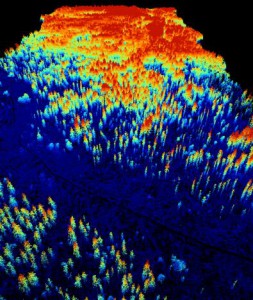
 A new MSc. student started her thesis “Suitability of Light detection and ranging (LiDAR) data and texture measures of aerial images to model the species distribution of Glaucidium passerinum (Pygmy Owl) in Vercors, French Alps”. Wanda Graf is using LiDAR data to describe the three dimensional habitat structure of Glaucidium passerinum at different scales. Moreover texture measures of aerial images will be used to describe the habitat structure of Glaucidium passerinum at different scales. It is assumed that LiDAR data are more suitable to model the distribution of Glaucidium passerinum than texture measures of aerial images. The thesis is supervised by Dr. Björn Reineking and Dr. Martin Wegmann
EOCap4Africa Training in Kinshasa
This week, 14 students are attending a test run of our Remote Sensing module on Remote Sensing for Biodiversity Conservation at the University of Kinshasa. This module is part of the EOCap4Africa project (funded by the Federal Agency for Nature Conservation, lead Dr....


