


Berlin, where he investigated the stratigraphic record of the Anthropocene in lacustrine sediments. He has gained professional experience in environmental assessment and GIS analysis and is currently working in the public sector on geoscience projects.
In his PhD, Lukas is investigating the potential of UAV-based remote sensing technologies – such as multi- and hyperspectral imagery and high-resolution RGB photography – for the efficient and accurate localization of large fossil vertebrate skeletons and trace fossils. His research aims to improve the search for fossils through advanced aerial survey methods.
follow us and share it on:
you may also like:
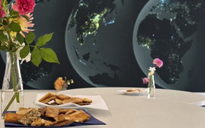
25 Years of Earth Observation in Würzburg: A Celebration to Remember
What a day. On July 16th we finally got to celebrate something we'd been building toward for months: 25 years of the Earth Observation Research Cluster, together with 10 years of EAGLE (that is still being celebrated and will get its own post next week). Around 250...
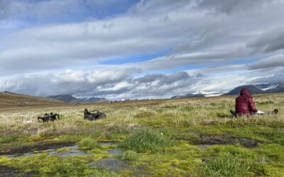
Updates from the High Arctic: Ronja’s Summer Field Campaign in Reindalen
Following our joint winter campaign, former EAGLE and UNIS research assistant Ronja Seitz has recently returned to the remote valley of Reindalen for her summer fieldwork. As part of her Arctic Field Grant project, Ronja is recording high-resolution UAV data...
Preparations in full swing
The countdown is on. With our combined 25th anniversary of EORC and 10th anniversary of EAGLE just around the corner, the whole cluster has been buzzing with preparation. And we mean the whole cluster, staff and students alike have been pitching in on everything from...
ANOTHER REPLY TO THE PROGRAMMING HERO SYNDROME
In the Programming Hero post, a lot of us (EAGLE students) recognized ourselves, at least in the situations around it. Since the other perspective usually goes unseen and underestimated, it's time the Silent Hero got a word in too, and explained why this isn't about...
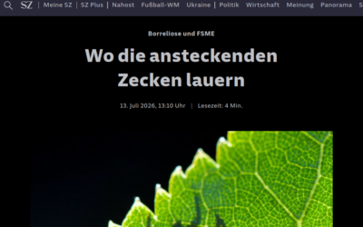
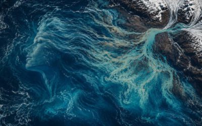
In the News: Monid Habitrack Featured in Süddeutsche Zeitung
Süddeutsche Zeitung recently covered our Monid Habitrack project, and we're happy to share it. The article follows the research team at work in the Oberpfalz, where our drones map vegetation and surface temperature while ticks are collected on the ground and tested...

EO4CAM PhD Students Present their Research at the GeoSeries Colloquium
On July 9, 2026, Daniel Gruschwitz and Sonja Maas from the Earth Observation Research Cluster (EORC) presented their current research in EO4CAM at the GeoSeries - Research Colloquium of the Institute of Geography and Geology, University of Würzburg, chaired by Prof....