New publication on downscaling and projection of population
Last year, Prof. Dr. Yuyu Zhou (back then affiliated with the Iowa State University, USA, now at the University of Hong Kong, Hong Kong), had visited DLR and gave an inspiring lecture. We had reported on this – see here: https://remote-sensing.org/prof-dr-yuyu-zhou-from-iowa-state-university-gives-an-invited-presentation/ . This was the starting point for collaboration on joint research on population downscaling and projection.
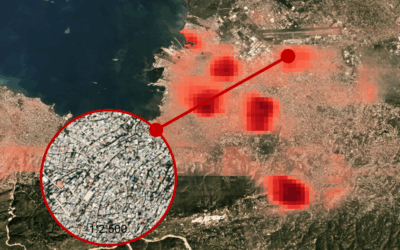
Dr. Eleanor Stokes from NASA, who had also visited DLR and our Earth Observation Research Cluster (EORC) last year ( https://remote-sensing.org/invited-talk-by-dr-eleanor-stokes-from-nasa-at-dlr-eoc/ ; https://remote-sensing.org/eleanor-stokes-from-nasa-talked-at-eorc/ ) also contributed in this collaboration. Beyond these institutions, the Earth Observation Center (EOC) of the German Aerospace Center (DLR), the Chinese Academy of Sciences in Shenyang, the Agricultural University in Beijing, the Zhejiang University of Finance & Economics in Hangzhou in China, the Iowa State University and the St. Cloud State University in the USA were part of this research study. The paper titled “Spatially explicit downscaling and projection of population in mainland China” was just published in the journal Science of the Total Environment by Wenru Xu, Yuyu Zhou, Hannes Taubenböck, Eleanor C. Stokes, Zhengyuan Zhu, Feilin Lai, Xuecao Li & Xia Zhao.
Here is the abstract of the paper: Spatially explicit population data is critical to investigating human-nature interactions, identifying at-risk populations, and informing sustainable management and policy decisions. Most long-term global population data have three main limitations: 1) they were estimated with simple scaling or trend extrapolation methods which are not able to capture detailed population variation spatially and temporally; 2) the rate of urbanization and the
spatial patterns of settlement changes were not fully considered; and 3) the spatial resolution is generally coarse. To address these limitations, we proposed a framework for large-scale spatially explicit downscaling of populations from census data and projecting future population distributions under different Shared Socio-economic Pathways (SSP) scenarios with the consideration of distinctive changes in urban extent. We downscaled urban and rural population separately and considered urban spatial sprawl in downscaling and projection. Treating urban and rural populations as distinct but interconnected entities, we constructed a random forest model to downscale historical populations and designed a gravity-based population potential model to project future population changes at the grid level. This work built a new capacity for understanding spatially explicit demographic change with a combination of temporal, spatial, and SSP scenario dimensions, paving the way for cross-disciplinary studies on long-term socio-environmental interactions.
Here is the link to the full paper: https://www.sciencedirect.com/science/article/pii/S0048969724037707


