Postdoctoral Research Associate (TV-L E13)
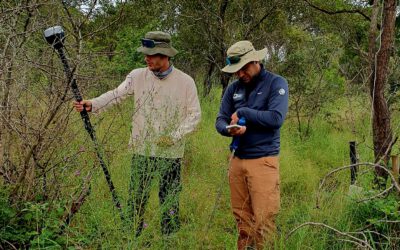
Remote Sensing based Assessment of Cotton Production in Pakistan
 The Department of Remote Sensing, University of Würzburg, is looking for a self‐motivated and team‐oriented fulltime (100%) Post-Doc research associate, starting from March 2017 until February 2020. The successful candidate will conduct her/his work in the context of the international project InoCottonGrow (Innovation to Reduce the Water Footprint of the Global Cotton Textile Industry towards the SDGs of the UN) funded by the German Federal Ministry for Education and Research (BMBF). Focus is set on remote sensing of water use efficiency and productivity of cotton production to support the assessment of the water footprint of cotton. The methods will be developed in Pakistan and transferred to Turkey. In case of mutual interest of the department and the successful candidate, a further career at the department is possible. The call is conditional on the decision of project funding.
Our department:
The Department of Remote Sensing is based within an institutional cooperation with the German Aerospace Center (DLR), especially with the German Remote Sensing Data Center (DFD). The research of the department focuses on the development and application of remote sensing methods in the core fields of “sustainable land management”, “ecosystem functioning, and biodiversity” as well as “applied environmental modelling and forest inventory”. We are an ambitious team of young scientists at PhD and Post Doc level. We offer to work in a strong international network with numerous organizations in research and practice, particularly in Central and South Asia and West Africa. To gain teaching experience we offer to contribute to our international MSc study programme in remote sensing and GIS (www.eagle-science.org) and to our international MSc study programme Global Change Ecology at the University of Bayreuth.
Requested fields of research and main tasks:
-
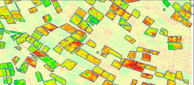
Remote sensing and GIS analysis for environmental modelling of biophysical variables (evapotranspiration and biomass/crop yield) as well as crop mapping,
-
Specification and implementation of indicators for cotton production assessment,
- Work effectively as a researcher as part of a multi-disciplinary national research team, to undertake independent scientific investigations and carry out/delegate associated tasks,
-
Communication and active design of implementation in cooperation with partners, including short research visits to the partner organizations, field trips, and organization of workshops and team meetings,
-
Support in supervision of PhD, MSc, and BSc students in the context of the project.
Expected skills and competences:
-
High-quality doctoral degree (summa / magna cum laude or equivalent) in geography or related fields,
-
A sound knowledge in programming and remote sensing, and good skills in GIS (e.g. QGIS, ArcGIS),
-
International research experience, at the same time a strong orientation towards implementation and willingness to engage in collaboration across scientific disciplines and with project partners in Central Asia and Africa,
-
Well-founded experience in project management and project coordination is advantageous,
-
Successful publication history, particularly in peer reviewed refereed journals,
-
Excellent English skills (both written and spoken),
-
Good ability to represent the research team effectively internally and externally, including at national and international conferences
-
Professional and respectful behaviour and attitude in a collaborative environment.
The successful candidate will receive a position for three years (TV-L E13). Please submit your application (in English) and including the reference number 2017/InoCottonGROW) containing a cover letter, motivation letter (2 pages maximum), curriculum vitae with list of publications and project history, copies of diplomas, certificates or references from employers, by E-Mail to Prof. Dr. Christopher Conrad, University of Würzburg: christopher.conrad@uni-wuerzburg.de.
Further information:
Application must be submitted by February 6th 2017. For further information on the Department of Remote Sensing, candidates are encouraged to consult the department’s website http://www.geographie.uni-wuerzburg.de/en/fernerkundung_neu/startseite/.The University of Würzburg is an equal opportunity employer that tries to increase the number of women in research and teaching. Applicants with disabilities but otherwise equal qualifications will be preferred.