
Presenting Our UAS Research at the UFS Science Team Meeting

Presenting Our UAS Research at the UFS Science Team Meeting

m

December 4, 2025

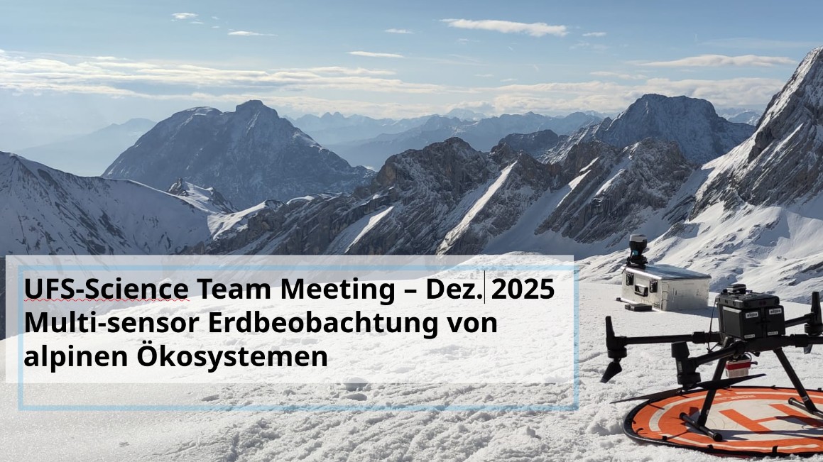
At the recent UFS (Umweltforschungsstation Schneefernerhaus) science team meeting, our group had the opportunity to present current and planned UAS-based research activities in the high-mountain environment surrounding the Zugspitze. The meeting offered an ideal setting to share our progress, discuss technical challenges, and explore collaborative perspectives with colleagues working across a wide range of alpine research topics.

Our presentation focused on the use of LiDAR, thermal, and multispectral UAS sensors to investigate snow properties, as well as applications in geomorphology, biology, and informatics. A central highlight was our first set of LiDAR-based snow height results from a 2000 × 250 m transect on the Zugspitzplatt, surveyed using UAS in combination with in-situ snow measurements.

The initial outcomes are promising:

  • We can map snow surface properties at a spatial resolution of 2 cm, and

  • Achieve vertical snow-height accuracy of approximately ±2 cm using UAS LiDAR..

We also discussed current challenges, particularly the limited validation of snow depth above 2.5 m, as our snow probes only reach this length. As a result, measurements for deeper snowpacks could not be validated during this campaign — a clear point for improvement in future fieldwork.

Beyond the technical insights, the meeting revealed many shared research interests with other UFS partners, including teams working on glacier dynamics, permafrost monitoring, and snow science. These overlaps open encouraging possibilities for future collaboration, both within the UFS science team and across the broader alpine research community.

We look forward to continuing these conversations and strengthening our contributions to high-mountain environmental research.

follow us and share it on:

you may also like:

The 6 Species of Remote Sensing Researchers

The 6 Species of Remote Sensing Researchers

A fun field guide of earth observation scientists at our EORC, a typology of 6 Species of Remote Sensing Researchers (we could not think of more yet ...) There’s a magical moment in every remote sensing get-together when six completely different personalities somehow...

EORC’s River Research at EGU General Assembly 2026

EORC’s River Research at EGU General Assembly 2026

The European Geosciences Union General Assembly is one of the major annual meetings for the Earth, planetary, and space sciences, bringing together more than 20.000 scientists from around the world to discuss the latest findings in their fields. EGU26 in Vienna...

Polar 6 on Svalbard

Polar 6 on Svalbard

The EORC team, particularly Dr. Jakob Schwalb-Willmann and Dr. Mirjana Bevanda, had the chance to catch up with our former Msc student Luisa Wagner in Longyearbyen, Svalbard. Luisa is pursuing her PhD at the Alfred-Wegener-Institute (AWI), where her research focuses...

EOCap4Africa closing meeting

EOCap4Africa closing meeting

The EOCap4Africa project officially concluded with an online closing meeting bringing together our project partners, lecturers, researchers, and institutional representatives from across Africa and Europe. The meeting was attended by our African partners from...

NetCDA at EGU26

NetCDA at EGU26

At the EGU General Assembly 2026 in Vienna, the NetCDA framework organized the session “ITS4.33/CLO.19: Strengthening African-European Partnerships for Global Change Research: From Scientific Capacity to Practical Solutions” on 4 May 2026. The session was convened by...

Privacy Policy

Lehrstuhl für Fernerkundung & Lehrstuhl für Urbane Fernerkundung

Erdbeobachtung an der Universität Würzburg

Share This