A remote sensing and GIS training for professional development aid staff members was conducted last month. Within 5 days the participants learned the basics of spatial data handling, creating maps, acquiring remote sensing data and earth observation products up to doing first steps in GoogleEarthEngine. The practical desktop exercises were done using QGIS and its powerful expression functions and geometry generators. Despite the challenging situation did we receive quite positive feedback about our virtual training but of course we are looking forward to do in-person trainings again once the are allowed.
Presentation at the Kolloquium of the Technical University of Graz
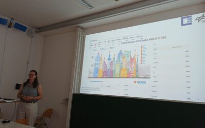
Dr. Ariane Droin presented the works of her PhD-Thesis at the Geo-Kolloquium of the Technical University of Graz with the title "Hochauflösende, skalenübergreifende Modellierung von Nachbarschaftserreichbarkeiten im urbanen Raum" on the 17th of June 2026. She showed...