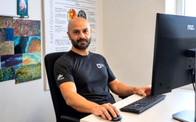
At our EORC, researchers from around the world work together to better understand environmental change using Earth observation. Among them is Ása Dögg Adalsteinsdottir, whose work connects satellite remote sensing with geomorphology and environmental hazards in northern landscapes.
Originally from Iceland, Ása brings a strong connection to Arctic and sub-Arctic environments into her research. Growing up surrounded by dynamic volcanic and glacial landscapes sparked an early interest in Earth surface processes and the ways they shape both natural environments and human infrastructure.
Investigating landscape dynamics with satellite data
Ása’s research focuses on using satellite-based remote sensing methods to monitor geomorphological processes and environmental hazards. One example of her work analyzes slope deformation and rockslide activity in northern Iceland, where unstable slopes can threaten roads and infrastructure. Using time series from the Sentinel‑1 mission and differential interferometric SAR techniques, she investigates ground movement patterns to better understand landscape instability in glacially shaped terrain.
By combining satellite observations with geological knowledge of Arctic landscapes, her work contributes to identifying hazardous areas and improving long-term monitoring of environmental change.
From Iceland to Würzburg: international research collaboration
At the EORC, Ása works within an international and interdisciplinary research environment. The cluster brings together expertise in satellite remote sensing, drone-based Earth observation, and environmental modeling to address major global-change challenges such as biodiversity loss, climate change, and sustainable land management.
This collaborative setting allows her to integrate geomorphology, remote sensing, and geospatial analysis to study landscape processes across different spatial and temporal scales.
Why remote sensing?
For Ása, remote sensing offers a powerful way to observe dynamic landscapes that are difficult to access on the ground. High-latitude environments, in particular, often experience rapid environmental change while also being geographically remote and logistically challenging to monitor.
Satellite observations make it possible to analyze these regions continuously over long time periods, enabling scientists to detect subtle landscape changes and better understand how environmental systems respond to climate and geomorphic processes.
Looking ahead
Through her research at the EORC, Ása aims to advance the use of Earth observation for monitoring geohazards and environmental change in northern environments. By combining satellite data with geomorphological insights, her work helps improve our understanding of landscape stability and contributes to safer and more resilient infrastructure planning in vulnerable regions.
As Earth observation technologies continue to evolve, researchers like Ása are helping to unlock new ways of observing and understanding our planet—from orbit to the most remote landscapes on Earth.