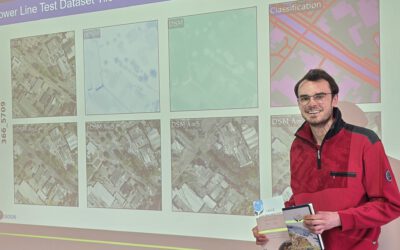
We’re happy to announce that our PhD student Adomas Liepa has successfully defended his doctoral thesis, titled “Potential of Satellite Earth Observation in Seasonal Monitoring of Complex Agricultural Environments of East Africa”, on Thursday, July 24th at 11:00 AM. This marks a significant achievement not only for Adomas but also for the growing field of applied Earth Observation in agriculture and climate resilience.
Adomas’s work addresses one of the most pressing challenges in remote sensing: capturing crop phenology—the timing of key plant growth stages—in diverse and dynamic smallholder farming systems. These systems, which dominate much of East Africa, are highly sensitive to climate variability, rainfall dependency, and biotic stressors such as pests and diseases. With the agricultural calendar shifting due to climate pressures, Adomas’s research offers critical tools for monitoring and adaptation.
🌱 What Did He Do?
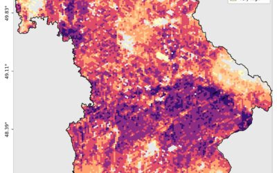
Adomas developed a novel, high-resolution vegetation monitoring approach that harmonizes data from Sentinel-2 and Landsat 7, 8, and 9, unlocking the ability to generate dense NDVI (Normalized Difference Vegetation Index) time series with cloud-based processing. This fusion enabled precise detection of growing season dynamics in places where conventional monitoring falls short.
In Uganda’s Kamuli district, his method captured clear planting and harvesting windows for 2022. But his work didn’t stop at calendar dates—it dug deeper into resilience metrics..
🌾 From Uganda to Kenya: Mapping Resilience with Satellites
Transferring the methodology to Southwestern Kenya, Adomas compared conventional maize monoculture with the Push-Pull intercropping system—a climate-smart, pest-resistant agricultural practice. His analysis across 15 growing seasons and 58 field sites revealed that Push-Pull systems not only weathered harsh conditions better but also exhibited higher NDVI peaks and longer growing seasons, even during locust invasions and armyworm outbreaks.
These insights represent a first-of-its-kind use of satellite data to measure the agroecological resilience of alternative farming practices at scale. It’s a pioneering step toward integrating Earth Observation with sustainable agricultural development.
🌳 Bridging Ecosystems: From Africa to Bavaria
To test the flexibility of his method, Adomas applied it to forest understory phenology in Upper Franconia, Germany, comparing satellite data with on-the-ground camera trap observations. The results? Strong alignment—proving his technique’s adaptability beyond croplands and across continents.
📡 Why It Matters
Adomas’s thesis is more than a technical achievement—it’s a vision for agriculture and ecosystem monitoring in the age of climate change. His work equips researchers, policymakers, and farmers with scalable tools for understanding when, where, and how vegetation responds to environmental stress.
By blending fieldwork, cloud computing, and satellite data, he has created a pathway for more resilient, data-driven agriculture—from small farms in East Africa to managed forests in Europe.
🎉 Please join us in congratulating Dr. Adomas Liepa for this remarkable accomplishment and contribution to the field of Earth Observation and agricultural sustainability. We look forward to seeing where his research takes him—and all of us—next!