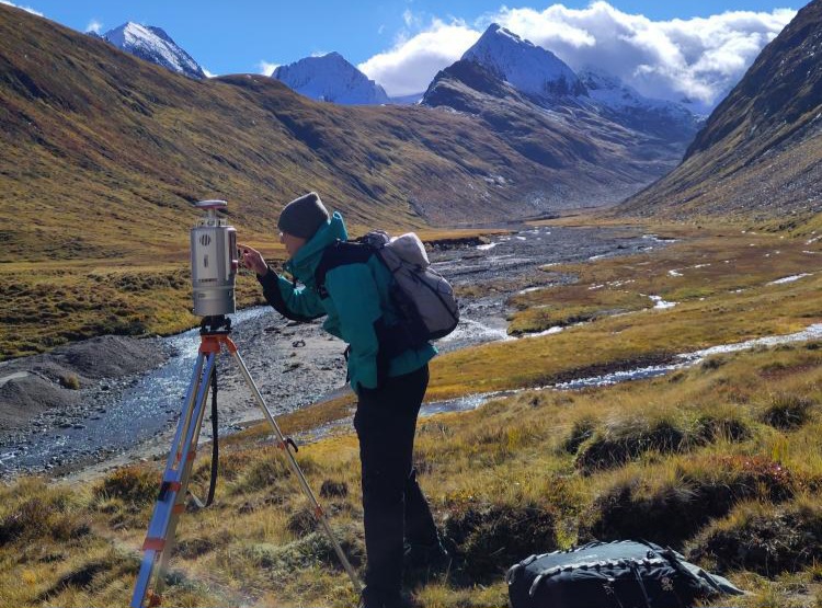
Last week, Laura, an 8th gen EAGLE Student, participated in the Summer School of Alpine Research, conducted by the University of Innsbruck, in the beautiful location of the Austrian Oetztal in Obergurgl. The focus of the Summer School was on Close Range Sensing Techniques for investigating Alpine Environments. Talks by experts from TU Delf, TU Wien, TU Dresden, TU Munich and Heidelberg University were accompanied by fieldwork to collect and analyze data on the alpine environment.
Laura’s group was assigned with quantifying erosion rates along an alpine riverbed through Terrestrial Laser Scanning (TLS). After the fieldwork, the analysis of the multitemporal 3D point clouds with the py4Dgeo Python library and in CloudCompare followed. The group aims at publishing the results in the ISPRS Journal of Photogrammetry and Remote Sensing. If successful, the work will also be presented by one of her colleagues at the ISPRS Geospatial Week in Dubai in April 2025.
The Summer School of Alpine Research is organized every two years by the University of Innsbruck and focuses on LiDAR, photogrammetry and thermal sensors. During this year’s summer school, interdisciplinary topics like creating a digital twin of the valley as well as creating 3D models of rock climbing routes were also concerned.
Links:
https://www.uibk.ac.at/en/geography/sensing-mountains/2024/
https://py4dgeo.readthedocs.io/en/stable/intro.html
you may also like:
KI4Stereo – Hybrid kick-off meeting at DLR
KI4Stereo – Hybrid kick-off meeting at DLR: AI-based analysis of stereo image data for tree monitoringOn January 23rd, 2026, a hybrid kick-off meeting was held at DLR to officially launch the research project KI4Stereo (funded under the KMU-innovativ programme,...
Sebastian Buchelt successfully defends PhD on SAR-based monitoring of alpine permafrost
We are very pleased to congratulate our PhD student Sebastian Buchelt on his successful defense of his dissertation, “Potential of Synthetic Aperture Radar time series for mapping and monitoring of small-scale periglacial processes in alpine environments.” His work...
New publication explores how forest structure shapes beetle communities
A new peer-reviewed publication investigates how between-patch heterogeneity and old-growth forest attributes influence the structure of beetle metacommunities in temperate forests. The study, led by Dr. Oliver Mitesser from the Biology Department, combines...
Cubes & Clouds – Cloud-Native Open Data Science for Earth Observation
From 9–13 February 2026, EAGLE Master students took part in the block course “Cubes & Clouds – Cloud Native Open Data Sciences for Earth Observation”, taught by Dr. Insa Otte, Steve Hill, and Peter Zellner (DLR). The course introduced key concepts such as data...
From Earth Observation to Industry: Insights from a graduate at Airbus
Dr. Marius Philipp recently returned to our EORC at the University of Wuerzburg to share insights from his work at Airbus, where he spoke about his work in AI, data science, and applied Earth Observation. His talk highlighted how analytical thinking, remote sensing...
New Python package for the development of analysis ready Sentinel-2 datacubes
We are pleased to announce that our PhD student Baturalp Arisoy has just released the open soure Python package stac2cube, dedicated to transform Sentinel-2 satellite imagery into analysis ready data. The package addresses a number of typical challenges arising during...


