Agricultural remote sensing fieldwork in Tanzania February 2023

Agricultural remote sensing fieldwork in Tanzania February 2023

March 15, 2023

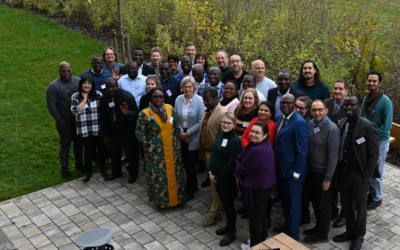
As part of EU-funded project UPSCALE our PhD researcher Adomas Liepa organised a data collection campaign to Mwanza, Tanzania. Working together with the local agricultural researchers from Tanzanian Agricultural Research Institute (TARI) valuable insights into farming practices, local farming tendencies and growing season projections were evaluated. During the fieldwork, coordinates, landcover data and farmer insights were collected. This will be used for high-resolution land cover map generation and in the broader context, to combine farmer perspective, climate and remote sensing data in tackling future agricultural challenges of East Africa.

you may also like:

Field Excursion to Owabi Wildlife Sanctuary

Field Excursion to Owabi Wildlife Sanctuary

As a highlight of the third day of our training at KNUST on the use of remote sensing for biodiversity conservation, we took our participants on a field excursion to the nearby Owabi Wildlife Sanctuary. Guided by experienced local experts, we explored the area and had...

Expedition to Central Asia in the frame of the FluBig project

Expedition to Central Asia in the frame of the FluBig project

Since mid of September, a team from the Earth Observation Research Cluster is on a field expedition at the Naryn River in Kyrgyzstan. The team is acquiring data on vegetation and hydro-geomorphic features for the DFG funded "FluBig" project which is dedicated to...

EOCap4Africa training in Kumasi

EOCap4Africa training in Kumasi

Today, we launched the testrun for our MSc module on Remote Sensing for Biodviversity Conservation which forms part of the EOCap4Africa project (funded by the Federal Agency of Nature Conservation) at the Kwame Nkrumah University of Science and Technology (KNUST) in...

Final workshop on research project OptiPlan

Final workshop on research project OptiPlan

Final workshop on research project OptiPlan (Ein innovatives KI-basiertes Planungstool zur Verkehrserfassung für nachhaltiges Flächenmanagement mittels Kamera- und Satellitenbilddaten)On September 19, 2025, the consortium of the OptiPlan project (German Aerospace...

Writing in Progress Across Europe!

Writing in Progress Across Europe!

This week, members of the COST Action DSS4ES from all over Europe — including colleagues from Türkiye — have gathered at the Earth Observation Research Cluster of the University of Würzburg for a dedicated writing retreat. Our goal? To collaboratively shape the...