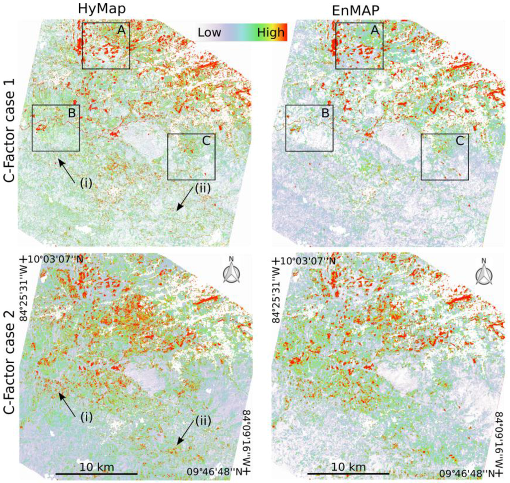
 The outcome of one of our MSc students, Sarah Malec, got published in Remote Sensing titled “Capability of Spaceborne Hyperspectral EnMAP Mission for Mapping Fractional Cover for Soil Erosion Modeling”. Soil erosion can be linked to relative fractional cover of photosynthetic-active vegetation (PV), non-photosynthetic-active vegetation (NPV) and bare soil (BS), which can be integrated into erosion models as the cover-management C-factor. This study investigates the capability of EnMAP imagery to map fractional cover in a region near San Jose, Costa Rica, characterized by spatially extensive coffee plantations and grazing in a mountainous terrain. Simulated EnMAP imagery is based on airborne hyperspectral HyMap data. Fractional cover estimates are derived in an automated fashion by extracting image endmembers to be used with a Multiple End-member Spectral Mixture Analysis approach. The C-factor is calculated based on the fractional cover estimates determined independently for EnMAP and HyMap. Results demonstrate that with EnMAP imagery it is possible to extract quality endmember classes with important spectral features related to PV, NPV and soil, and be able to estimate relative cover fractions. This spectral information is critical to separate BS and NPV which greatly can impact the C-factor derivation. From a regional perspective, we can use EnMAP to provide good fractional cover estimates that can be integrated into soil erosion modeling.