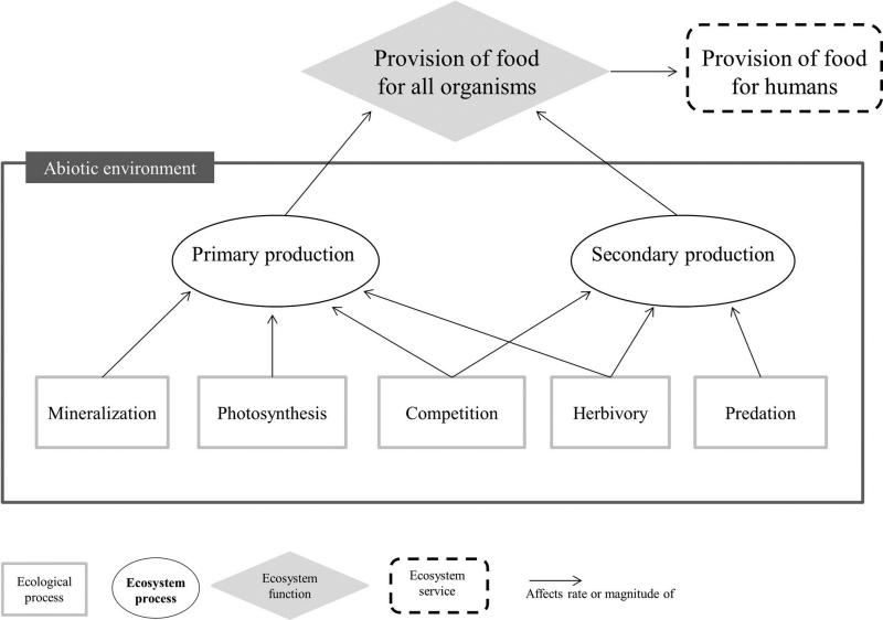

 A new publication on “Satellite remote sensing of ecosystem functions: opportunities, challenges and way forward” has been published in the recent issue of RSEC lead by Nathalie Pettorelli. From the abstract: “Societal, economic and scientific interests in knowing where biodiversity is, how it is faring and what can be done to efficiently mitigate further biodiversity loss and the associated loss of ecosystem services are at an all‐time high. So far, however, biodiversity monitoring has primarily focused on structural and compositional features of ecosystems despite growing evidence that ecosystem functions are key to elucidating the mechanisms through which biological diversity generates services to humanity. This monitoring gap can be traced to the current lack of consensus on what exactly ecosystem functions are and how to track them at scales beyond the site level. This contribution aims to advance the development of a global biodiversity monitoring strategy by proposing the adoption of a set of definitions and a typology for ecosystem functions, and reviewing current opportunities and potential limitations for satellite remote sensing technology to support the monitoring of ecosystem functions worldwide. By clearly defining ecosystem processes, functions and services and their interrelationships, we provide a framework to improve communication between ecologists, land and marine managers, remote sensing specialists and policy makers, thereby addressing a major barrier in the field.” read more here: