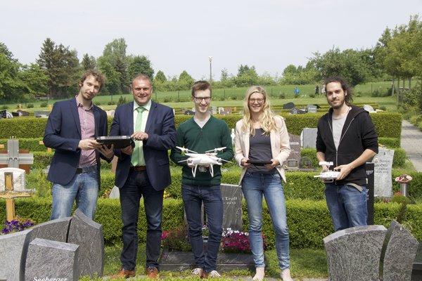
from left to right: Hendrik Flock, Thomas Eberth, Florian Baumgartner, Carina Kübert and Steven Hill, source: MainPost
Florian Baumgartner started his B.Sc. thesis titled “Object-oriented derivation of a digital cemetery plan from very high resolution aerial imagery – a case study for the municipality of Kürnach”. The aim of his thesis is to derive a high-resolution UAV-based graveyard map that can be used by the municipality for further planning within the cemetery administration.
Florian has already planned and performed an overflight with our Phantom 4 drone that took place in April this year. Watched by the mayor of Kürnach (Thomas Eberth), a representative of the AKDB (public agency developing IT solutions for municipal authorities, Hendrik Flock) our UAV expert (Steven Hill) and me (mentoring the thesis), the drone was flying at a height of 30m for 15 minutes and took more than 200 images.
The images will be used to derive a georeferenced orthophoto as well as a three-dimensional Digital Surface Model.
Florian will apply object-oriented segmentation and classification methods in order to develop a digital cemetery map. His thesis can be seen as a feasibility study within the process of the digitization of administrative tasks.
More information can be found here:
Best practice Tutorial for low budget UAV (in English and German)
report written by the municipality of Kürnach (in German only)
report written by AKDB (in German only)
report of the local daily newspaper MainPost (in German only)