A Successful Day in the Field: Grassland Sampling in the Bavarian Rhön

A Successful Day in the Field: Grassland Sampling in the Bavarian Rhön

September 9, 2025

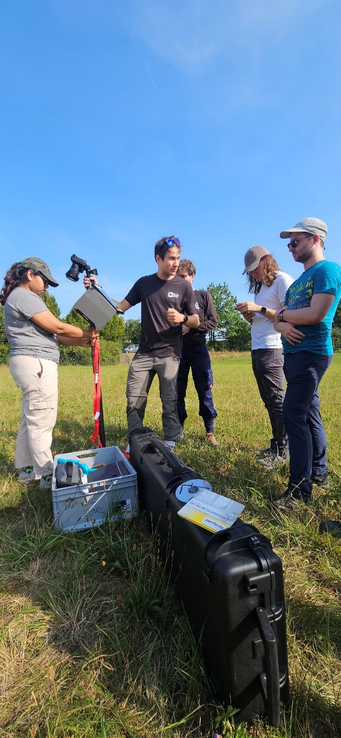
On August 21st, the EO4CAM project team embarked on a successful field campaign in the surroundings of Bad Neustadt an der Saale, the district capital of Rhön-Grabfeld in Lower Franconia. The Bavarian Rhön serves as a pilot region within EO4CAM, providing a rich experimental landscape for in-depth studies, such as detailed investigations of grasslands.

The field day focused on a comprehensive and standardized sampling of grassland areas, aiming to collect high-quality data on several key parameters: grassland height, above-ground biomass, Leaf Area Index (LAI), canopy cover, and cover fraction. These measurements are essential for the calibration and validation of Earth observation-based grassland datasets that are developed within EO4CAM.

The fieldwork was conducted by EO4CAM staff from the DLR and the EORC and enthusiastically supported by students from the international EAGLE Master’s program. Their participation not only contributed to the success of the campaign but also provided valuable hands-on training in field methods and the use of state-of-the-art measurement instruments.

The students will further process and present the findings from the field day as part of the seminar ‘Field Methods’, deepening their understanding of grassland dynamics and remote sensing applications. This integration of research and education exemplifies EO4CAM’s commitment to fostering the next generation of environmental scientists.

Thanks to the friendly support of local landowners and stakeholders, the team was able to access and sample a diverse range of grassland plots. The collaboration ensured smooth logistics and enriched the campaign with local insights.

 

you may also like:

New study on invasive species in Rwanda

New study on invasive species in Rwanda

A new publication by EORC members Lilly Schell, Insa Otte, Sarah Schönbrodt-Stitt and Konstantin Müller, was just published   in the Journal Frontiers in Plant Science. Their study, “Synergistic use of satellite, legacy, and in situ data to predict spatio-temporal...

Poster Presentations at the GfÖ-Conference in Würzburg

Poster Presentations at the GfÖ-Conference in Würzburg

Being part of the organizers of this year's GfÖ-Conference in Würzburg our staff members Sonja Maas, Jakob Schwalb-Willmann and Maninder Singh Dhillon were happy to present the posters on their research topics today. The annual meeting of the GfÖ (Society for Ecology)...

Bridging Scales: How Radar Satellites supports Crop Monitoring

Bridging Scales: How Radar Satellites supports Crop Monitoring

In an era of climate uncertainty and increasing pressure on agricultural systems, understanding how crops grow and respond to environmental stress is more important than ever. A new study led by researchers from Martin-Luther-University Halle-Wittenberg, in close...

Upcoming PhD Defense by Ariane Droin

Upcoming PhD Defense by Ariane Droin

Ariane Droin will defend her PhD thesis "Permeabilität und Erreichbarkeit lokaler Nachbarschaften im urbanen Kontext. Eine geographische Analyse auf Basis räumlicher Netzwerke." on September 16th at 4 p.m. at the John-Skilton Straße 4a, Seminar Room 2/00.B.03.  ...

PhD Defense by Dorothee Stiller

PhD Defense by Dorothee Stiller

Dorothee Stiller will defend her PhD thesis "Potential of Remote Sensing Data and Methods for Urban Transport Research" on 15th of September at 4 p.m. at the John-Skilton Straße 4a, seminar Room 2/00.B.03. Everyone who is interested is cordially invited to join her...

Strengthening Collaboration with SANParks for Conservation Research

Strengthening Collaboration with SANParks for Conservation Research

Our long-standing collaboration with Dr. Corli Coetsee and Dr. Ben Wigley from SANParks is moving forward with promising new research activities. The joint work is focusing on mapping savanna features more accurately such as trees, paths, or animals through innovative...