As part of the exploration of UAS in crisis activation activities coordinated by the DLR Center for Satellite Based Crisis Information (ZKI), the EORC UAS research team contributed high-resolution airborne data to support the generation of geospatial products.
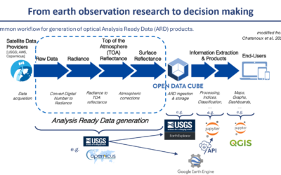
Our role in this crisis mapping exploration focused specifically on the provision of LiDAR point clouds and orthophotos derived from UAV surveys. These datasets were supplied to complement satellite-based analyses, enabling a more detailed representation of surface conditions where higher spatial resolution is required.
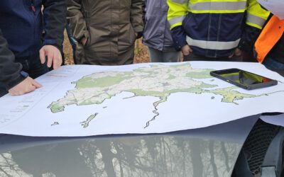
The data delivery was prepared and coordinated within the EORC UAS team and various EORC members helped in making it possible e.g. Dr. Sarah Schoenbrodt-Stitt, Dr. Mirjana Bevanda, Dr. Jakob Schwalb-Willmann, Antonio Castaneda-Gomez, Elio Rauth, …
The LiDAR data provides three-dimensional structural information, supporting terrain analysis and object detection, while the orthophotos offer geometrically corrected, high-resolution visual context. Together, these products can enhance the interpretability and accuracy of downstream mapping outputs.
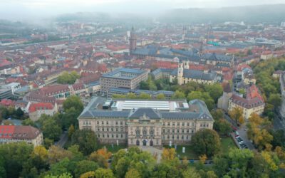
Compared to satellite imagery, UAV-based acquisition allows for targeted data collection at very high spatial resolutions and under flexible timing conditions. This makes it particularly suitable for capturing fine-scale features and supporting detailed assessments.
Within the context of this text our contribution was therefore primarily technical: ensuring that reliable, well-processed airborne datasets were made available in a timely manner to support the broader mapping workflow.
While ZKI activations are inherently collaborative, our involvement in this case centred on data provision and processing. The integration of UAV-derived LiDAR and orthophotos into such workflows reflects an increasing demand for multi-scale geospatial inputs in operational contexts.
We appreciate the opportunity to contribute these datasets and to support applied geospatial efforts through our research infrastructure and expertise.
read more about it here: https://activations.zki.dlr.de/de/activations/items/ACT164/