Exploring Arctic Vegetation Patterns: PhD Fieldwork on Svalbard

Exploring Arctic Vegetation Patterns: PhD Fieldwork on Svalbard

July 18, 2025

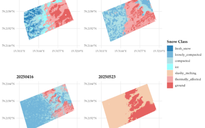
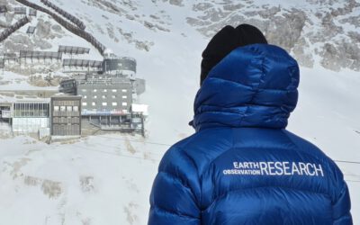
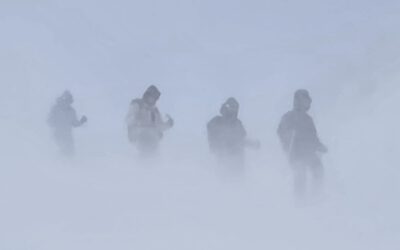
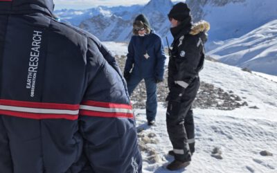
This summer, one of our PhD students, Elio Rauth, embarked on an exciting scientific journey to the High Arctic—conducting detailed vegetation surveys on the remote archipelago of Svalbard. The aim? To better understand the intricate mosaic of Arctic plant communities and how they vary across scales—from ground observations to UAS (drone) data and ultimately satellite imagery.

The fieldwork is part of a larger, ongoing collaboration with the University Centre in Svalbard (UNIS), focusing on UAS- and satellite-based remote sensing in polar environments. Our PhD student combines high-resolution multispectral drone flights with meticulous vegetation ground-truthing to link micro-scale patterns with broader landscape dynamics and is supervised by Prof. Tobias Ullmann.

The upscaling from UAS to satellite data enables us to analyze vegetation structure and distribution across spatial scales—crucial for detecting environmental change in one of the world’s most rapidly warming regions.

The research is conducted under the guidance of Dr. Mirjana Bevanda, head of our UAS research team, and benefits from the support of experienced team members, including Dr. cand. Jakob Schwalb-Willmann, Antonio Castaneda-Gomez, and Sebastian Buchelt. Together, this collaboration brings together field ecology, cutting-edge sensor technology, and scalable data processing to shed light on Arctic ecosystems.

We’re looking forward to the insights this work will bring—and to continuing our collaborative efforts with UNIS to push the boundaries of remote sensing in extreme environments.

Stay tuned for updates as we process the data and dive deeper into the Arctic’s green patterns.

follow us and share it on:

you may also like:

Exploring the Power of Orfeo Toolbox

Exploring the Power of Orfeo Toolbox

This week, our Eagle students have been soaring deeper into the world of spatial science with the Orfeo Toolbox (OTB) — a powerful open-source library for remote sensing image processing. Originally developed by the French Space Agency (CNES), OTB offers a rich suite...

Meet EORC at Upcoming Earth Observation Conferences & Workshops

Meet EORC at Upcoming Earth Observation Conferences & Workshops

The coming months offer many opportunities to connect with the Earth Observation (EO) community across a wide range of conferences, workshops, and focused scientific meetings. These events are not only places to present results, but also spaces for open exchange,...

A Strong Base at the Top: Research and Training at Schneefernerhaus

A Strong Base at the Top: Research and Training at Schneefernerhaus

We are grateful for the long-standing and growing opportunity to work with the Schneefernerhaus research station on Zugspitze, Germany’s highest mountain. For our work at the EORC, this collaboration provides an exceptional foundation for research on snow, ice,...

Snow Research at Schneefernerhaus, Zugspitze

Snow Research at Schneefernerhaus, Zugspitze

Recently, our team carried out another successful field campaign at the Schneefernerhaus research station on the Zugspitze in the Alps. Together with our EAGLE students, we collected UAS-based environmental data alongside detailed in-situ measurements of snow...

Privacy Policy

Lehrstuhl für Fernerkundung & Lehrstuhl für Urbane Fernerkundung

Erdbeobachtung an der Universität Würzburg

Share This