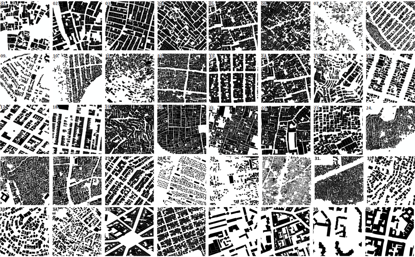

What began with a diploma thesis by Nicolas J. Kraff on the physical structure of slums in Mumbai, India, in 2011 has now culminated in a globally distributed dataset of building footprints covering 44 poverty and informal settlement areas across four continents.
Between 2011 and 2020, the mapping work developed from the analysis of individual settlements into a systematic global investigation of the morphology and dynamics of deprived urban areas using Earth observation data. Several studies laid the methodological and conceptual foundations for this research line:
- Kraff, N. (2011) Vergleiche megaurbaner Marginalviertel Mumbais durch ausgewählte Vulnerabilitätsfaktoren mittels hochaufgelöster Satellitendaten und Interviews, im Hinblick auf Beeinträchtigungen durch den Monsun. Diplomarbeit, Universität Trier. Trier
- Taubenböck, H., Kraff, N.J. (2014) The physical face of slums: a structural comparison of slums in Mumbai, India, based on remotely sensed data. Journal of Housing and the Built Environment, 29 (1), pp 15-38. Springer.
- Taubenböck, H., Kraff, N.J. & Wurm, M. (2018) The morphology of the Arrival City – A global categorization based on literature surveys and remotely sensed data. Applied Geography, 92, pp 150-167. Elsevier.
- Kraff, N.J., Taubenböck, H. & Wurm, M. (2019) How dynamic are slums? EO-based assessment of Kibera’s morphologic transformation. In: 2019 Joint Urban Remote Sensing Event, JURSE 2019, pp 1-4. IEEE. IEEE-CPS Joint Urban Remote Sensing Event (JURSE), 2019-05-21 – 2019-05-24, Vannes, France
- Kraff, N.J., Wurm, M. & Taubenböck, H. (2020) The dynamics of poor urban areas – analyzing morphologic transformations across the globe using Earth observation data. Cities, 107, pp 1-15. Elsevier.
- Kraff, N.J., Wurm, M. & Taubenböck, H. (2020) Uncertainties of Human Perception in Visual Image Interpretation in Complex Urban Environments. IEEE Journal of Selected Topics in Applied Earth Observations and Remote Sensing, 13, Seiten 4229-4241. IEEE – Institute of Electrical and Electronics Engineers.
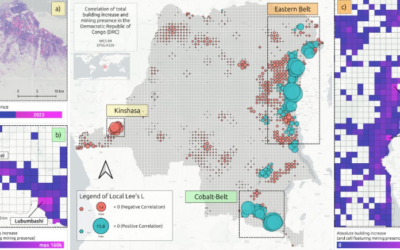
The resulting dataset brings together 321,075 individual building footprints and 4,661 building-block polygons from poor slum areas as well as informal settlement areas in Africa, the Americas, Asia, and Europe. Building footprints were generated through standardized Manual Visual Image Interpretation (MVII) of very-high-resolution imagery and subsequently harmonized to provide a consistent basis for comparative morphological analysis. Sixteen study sites additionally contain a second observation time step, enabling the analysis of urban morphological change. Please find the new publication titled “A manually interpreted geo-dataset of building footprints in complex urban poverty areas across the globe” here: https://www.nature.com/articles/s41597-026-07945-2
Beyond conventional GIS and urban morphological analyses, the dataset has particular relevance in the era of machine learning and artificial intelligence. The manually delineated building footprints can serve as labeled reference data for training, testing, and validating automated building detection and segmentation approaches. Although there are an increasing number of building layers, it is clear that, in many very dense and complex slum areas, their quality is not sufficiently accurate. With the rapid development of ML/AI methods for Earth observation, the availability of large, spatially distributed, accuracte reference datasets for complex and often underrepresented urban environments is becoming increasingly important. The dataset therefore provides a unique opportunity to investigate how the physical structure of deprived urban areas varies across geographical contexts and how building morphology can contribute to the understanding of poverty, informality, and socio-spatial inequality. At the same time, it offers an openly accessible data foundation for research in remote sensing, Earth observation, urban morphology, GIS, and automated image analysis.
After nine years of mapping and data development, we are particularly pleased to make this data foundation openly available to the scientific community. At a time when automated Earth observation and AI-based mapping are developing rapidly, we believe that these carefully curated human-generated reference data are particularly timely and valuable. The dataset is now available through the German Aerospace Center (DLR) EOC Geoservice. https://geoservice.dlr.de/web/datasets/building_footprints https://geoservice.dlr.de/data-assets/2wrrj8cpaj88.html
This current publication marks an important milestone in making this research foundation openly available. At the same time, it forms the basis for a broader data paper series: subsequent studies have continued to work with and extend the mapping of selected areas, including research on the spatiotemporal dynamics of slum populations in Caracas (Friesen et al., 2023), morphological change in Mumbai (Friesen et al., 2024), and the comparative analysis of manual slum identification in Medellín (Friesen et al., 2025). We aim to continue this work and make further datasets and related research available through future publications.
- Friesen, J., Kraff, N.J. & Taubenböck, H. (2023): Spatiotemporal dynamics of slums population in Caracas, Venezuela. In 2022 Joint Urban Remote Sensing Event (JURSE) (pp. 1-4). IEEE. Conference Paper.
- Friesen, J., Kraff, N. J., & Taubenböck, H. (2024). The Spatiotemporal Dynamics of Morphological Slums in Mumbai, India. IEEE Journal of Selected Topics in Applied Earth Observations and Remote Sensing.
- Friesen, J., Kraff, N.J. Kuffer, M., Georganos, S., Debray, H., Taubenböck, H., Samper, J. (2025): Comparative Analysis of Manual Slum Identification Using Satellite Data: A Case Study of Medellin, Colombia. Joint Urban Remote Sensing Event (JURSE) 2025, Gammarth-Tunis, Tunisia. Conference Paper
Finally, we would like to draw your attention to an overview of our extensive EO work on areas of poverty, informality and slums: https://remote-sensing.org/a-decade-of-research-on-poverty-slums-and-informal-settlements-with-remote-sensing/