At the CORP Planning Conference 2026 this week in Vienna, EORC and DLR contributed various presentations:
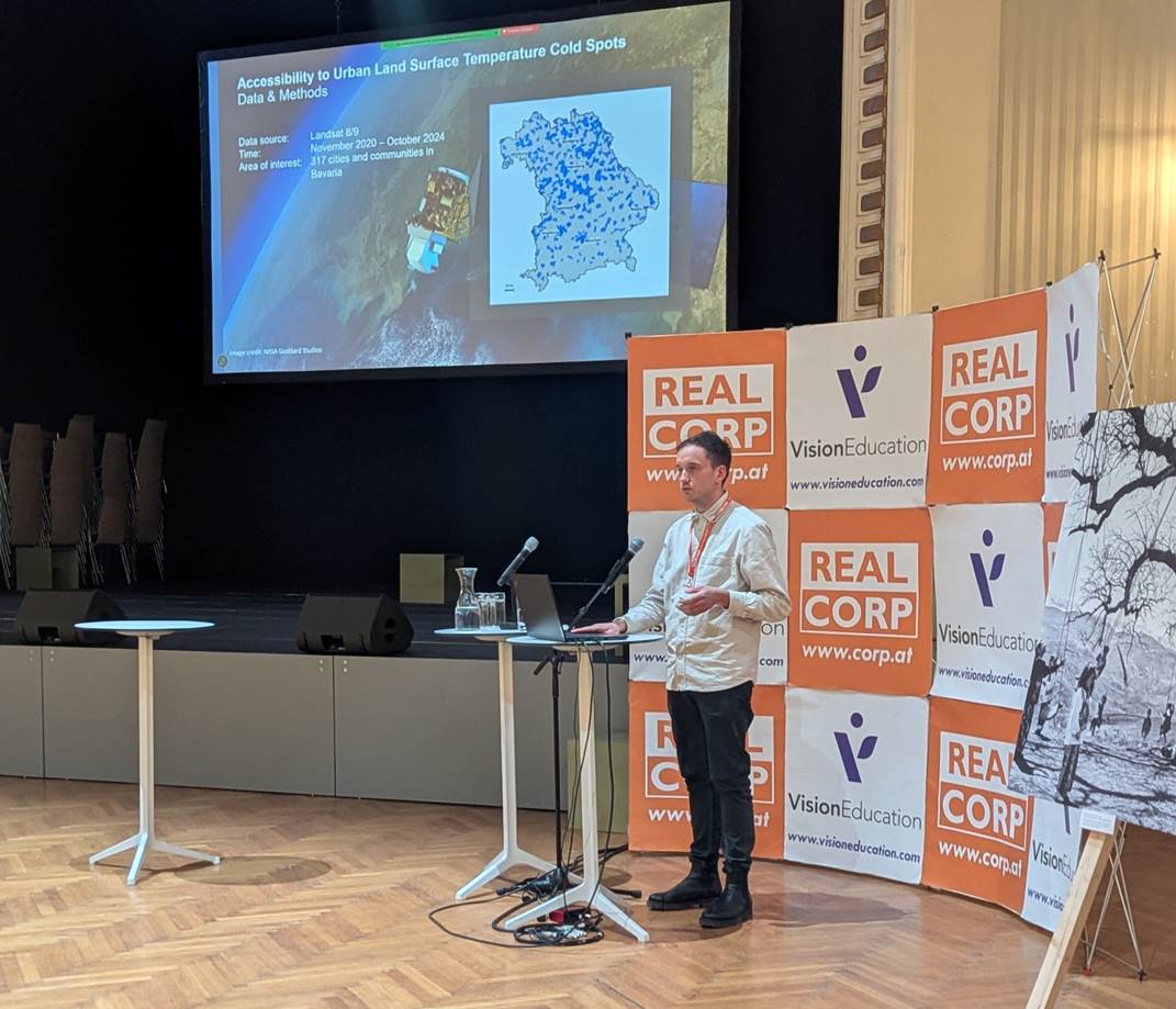
John Friesen presented a contribution from the EO4CAM project in the form of a conference paper and discussion session titled “Assessing Pedestrian Accessibility to Urban Land Surface Temperature Cold Spots in Bavarian Cities.” In this work, he investigates how spatial patterns of urban heat exposure intersect with everyday mobility conditions in Bavarian cities. Using high-resolution land-surface temperature data derived from Earth observation alongside pedestrian network analyses, the research evaluates the extent to which cooler urban areas are reachable by walking. By combining thermal remote-sensing products with geospatial accessibility modelling, the study provides new insights into the spatial equity of urban heat-mitigation resources.
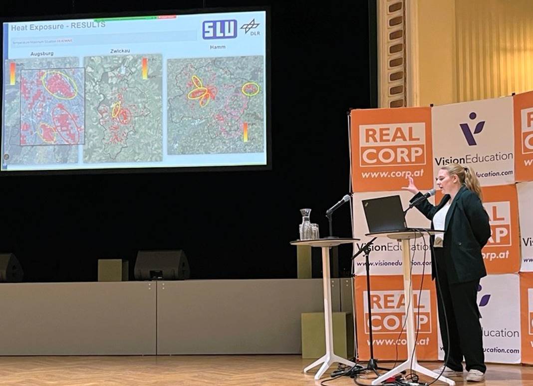
Marlene Kühnl presented a contribution from the HEATS project with the title “Identifying vulnerable populations under heat stress: A data-driven urban risk assessment using remote sensing, citizen science, and census data“. This study models heatwave exposure in three German cities and combines it with age-based social vulnerability. Higher weights are assigned to populations over 65 and under three due to increased health risks in regards to mortality and morbidity. The integration of these layers identifies localised heat risk areas on a 100 × 100 meter grid in order to support decision makers in identifying areas within the urban context where heat adaptation measures are most needed.
Furthermore, Marlene Kühnl presented a contribution from the Optiplan project. The paper with the title “Earth Observation and Open Geodata for Sustainable Urban Planning: A practical case study from Munich, Germany” was written and handed in by Dr. Tobias Leichtle. This study assesses potential land cover changes in a planned new development area in the northeast of Munich. Using reference sites throughout Munich, likely transformations are quantified and transferred to the project site. The approach shows how EO and open geodata can support decision making during urban planning processes.
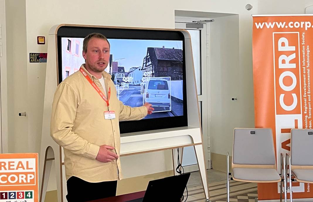
Jeroen Staab presented a contribution from the OptiPlan project, developed in collaboration with partners including DLR and Obermeyer, titled “From MS-COCO to FGSV: Developing and Validating a Hierarchical Classification Scheme for AI-Based Traffic Monitoring in Germany.” The work bridges the gap between modern computer vision models and the specific requirements of German traffic planning. Using a manually annotated dataset of over 17,000 traffic participants, the study introduces a hierarchical classification scheme linking international standards with FGSV guidelines and project-specific needs. Results show a clear trade-off: while generic classifications achieve high accuracy, performance decreases with increasing semantic detail—highlighting the need for domain-specific model adaptation in real-world applications. The presentation concluded with an interactive discussion, where technical insights were effectively translated into practical implications, fostering a deeper shared understanding between AI researchers and planning professionals.
Please find the proceedings papers of our contributions here: https://remote-sensing.org/contributions-to-the-realcorp-conference/