Category: News

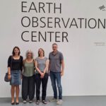
The “Geolingual Studies” team visited the DLR EOC
The “Geolingual Studies” team of the University Würzburg visited the DLR-EOC on 3 and...
Read More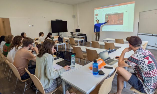
Course on Object-based image analysis
Dr. Michael Wurm from the German Aerospace Center (DLR) gave a class about Object-based image...
Read More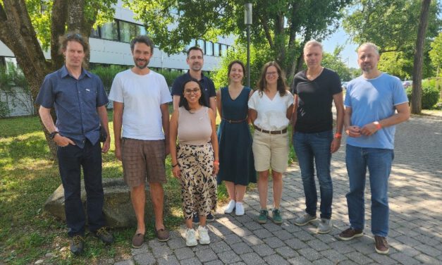
Strengthening Ties: Earth Observation Research Cluster Meets with DLR GZS Lecturers
Yesterday, members of our Earth Observation Research Cluster had the opportunity to connect with...
Read More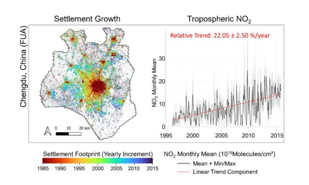
PhD defense by Thilo Erbertseder
Thilo Erbertseder will defend his PhD thesis “Satellite-based analysis of NO2 air pollution:...
Read More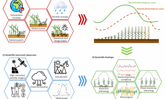
upcoming PhD defense by Adomas Liepa
Our PhD student Adomas Liepa will defend his Phd “Potential of Satellite Earth Observation...
Read More
EORC Staff and EAGLE Students at ESA Living Planet Symposium 2025
This week, our EORC team and EAGLE MSc students are joining the global Earth observation community...
Read More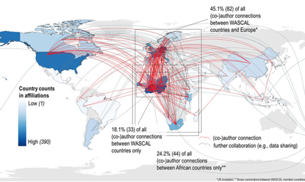
A Decade of Climate Research and Capacity Building in West Africa – Insights from WASCAL
Our colleagues Sarah Schönbrodt-Stitt and Michael Thiel, together with partners from University of...
Read More
New Research Published: A Spatial Decision Support System for Climate-Adapted Agriculture in West Africa
We are excited to announce the publication of a groundbreaking study titled “A Spatial...
Read More
Our Contributions to the ESA Living Planet Symposium 2025
This week, the global Earth observation community gathered in Vienna for the ESA Living Planet...
Read More
“Super-Test-Site Würzburg” consortium meeeting
The core team of our “Super-Test-Site Würzburg” consortium (University of Würzburg, the Karlsruhe...
Read More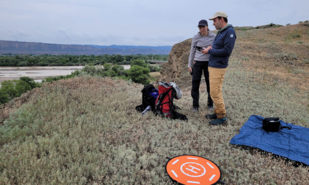
Successful fieldwork at the Naryn River in Kyrgyzstan
During the last week, EORC PI Florian Betz, EAGLE student Ariana Arguello-Cordero and FluBig team...
Read More
Alpine Earth Observation: Learning Remote Sensing Where Science Meets Nature
Last week, our Alpine Earth Observation course brought a group of EAGLE students high into the...
Read More