
New publication on global urbanization from 1985 to 2015 and its efficiency in terms of land consumption
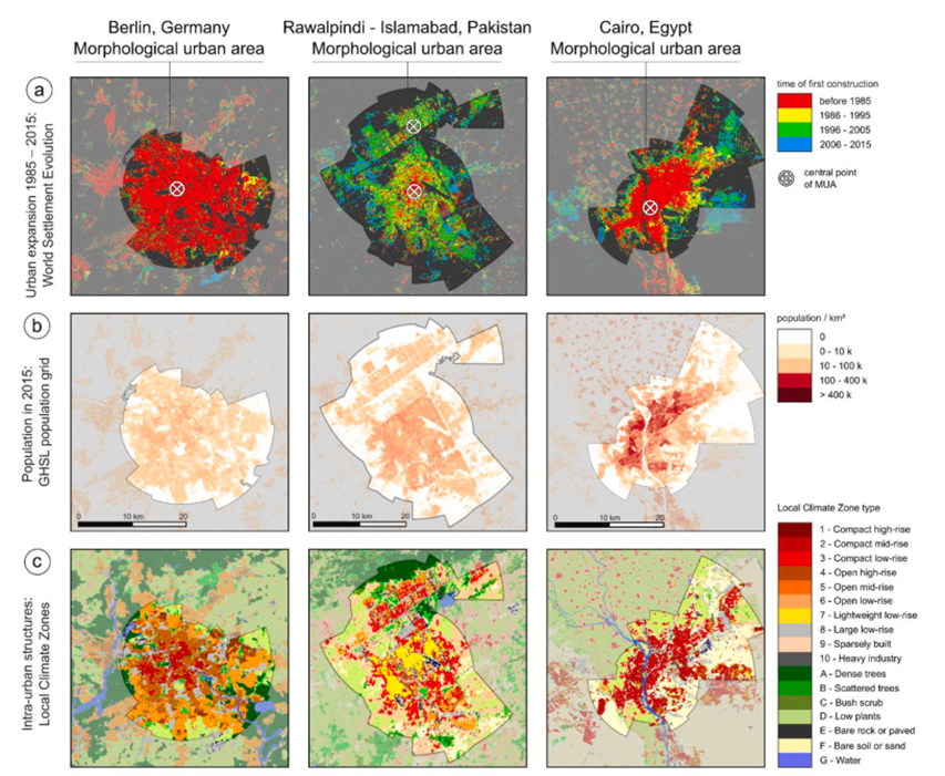
Researchers from the Earth Observation Center (EOC) of the German Aerospace Center (DLR) in Oberpfaffenhofen, our Earth Observation Research Cluster of the University of Würzburg, and from the University of Bonn teamed up for a study on global urbanization and its efficiency in terms of land consumption. The paper titled “Was global urbanization from 1985 to 2015 efficient in terms of land consumption?” was just published in the journal Habitat International by Hannes Taubenböck, Johannes Mast, Richard Lemoine Rodríguez, Henri Debray, Michael Wurm and Christian Geiß.
Here is the abstract of the paper: Dense cohabitation is associated with higher ecological sustainability and economic benefits than their less dense counterparts. Of course, there are also many challenges associated with high density, but from the perspective of land consumption, the global trend of urbanization is viewed positively. Urbanity and density, however, are and continue to develop very heterogeneously within and between cities. In this study, we analyze morphologic and demographic urban expansion across 1567 major cities around the globe from 1985 to 2015. Thereby, we investigate the changes in the morphological and population densities in the newly built areas in comparison to the status quo in 1985. Furthermore, we use the different densities in cities around the world to design theoretical retroactive scenarios of alternative land consumptions and determine possible carrying capacities. The key findings are: areas built between 1985 and 2015 are less dense in terms of morphology and population than the areas built before 1985. Thus, urban expansion consumed comparatively more land which means that it has become more inefficient with respect to the usage of space. We also find that this inefficiency varies around the globe, with South Asia and East Asia having higher densities in contrast to Europe and North America. The scenarios developed show the unutilized potential: If urban expansion would have been developed more densely, e.g. by ‘compact mid-rise’ structures, our model calculations show that 1.466 billion more people could live in the same newly built urban areas..
Here is the link to the full paper: https://www.sciencedirect.com/science/article/pii/S0197397525001134