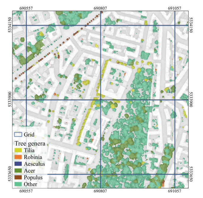

Urban tree classification is still a challenge for remote sensing, particularly in heterogeneous urban environments where tree genera are highly diverse and existing inventories often provide incomplete coverage. In our new study, we explore the potential of very high-resolution remote sensing to complement urban tree cadasters and provide large-scale information on the composition and diversity of urban forests, including trees on private properties that are often missing from city records.
Using the city of Munich as a case study, researchers from our Earth Observation Research Cluster (EORC) at the University of Würzburg, the Earth Observation Center (EOC) of the German Aerospace Center (DLR) in Oberpfaffenhofen, the Technical University of Munich, and the Company for Remote Sensing and Environmental Research (SLU) joined forces in the paper titled “How can remote sensing support urban tree cadaster efforts and diversity analysis of dominant genera?“, that was recently published in the IEEE Journal of Selected Topics in Applied Earth Observations and Remote Sensing. The authors are Andrea Sofía García de Leon, Tobias Leichtle, Ariane Droin, Julia Rieder, Antonio José Castañeda-Gómez, Thomas Rötzer, Klaus Martin, Tobias Ullmann and Hannes Taubenböck.
Here is the abstract of the paper: The study of urban trees is often limited by the incomplete coverage of official tree inventories, which generally exclude data from private lands. This limitation also restricts comprehensive analyses of urban forest composition. To address the lack of tree data, we developed a hierarchical approach for genus-level classification of urban trees using bi-temporal WorldView imagery, which was tested in Munich, Germany. We performed a diversity analysis of the dominant tree genera in the study area, comparing diversity metrics estimated with the remote-sensing-based classification with those derived from the official tree cadaster. We found that remote sensing can capture vegetation and tree patterns with an accuracy higher than 90% and identify dominant tree genera with a balanced accuracy of up to 87.7% depending on land use. We showed that remote sensing based diversity analysis of dominant genera can capture general spatial patterns despite certain limitations and can be comparable to cadastral-based analysis, with about 60% of the study area having a difference of less than 10% on the Simpson’s index. These results confirm the potential of remote sensing for complementing official tree cadaster efforts as it provides data on trees in private areas, which is necessary for a more complete understanding of urban forest composition.