


The Arctic Tundra on Svalbard is a fascinating ecosystem: The soil is covered by a large variety of plants during the summer, fueled by the light of the never-setting sun, painting Svalbard‘s valleys and slopes green. Then, with the arrival of the Arctic winter, snow begins to fall, covering the land surface and turning it white, before the dark season begins. The plants get buried by the snow and are set to last below the snow until the summer.
For plants and the Svalbard reindeer, the only large herbivore animal on Svalbard, the dynamic of the snow plays a critical role: During winter, the snow acts as an insulating layer, keeping the upper layer of the soil unfrozen, and protecting plants from icing and winds. The Svalbard reindeer, always on the lookout for resources both in winter and summer, can profit from optimal snow conditions: Well-protected plants are available as food in the winter (once the reindeer has found them by digging craters into the snow pack) and are in optimal conditions to resume photosynthesis and increase biomass once the snow melts in spring.
But which snow conditions are optimal for plants and reindeer to survive the winter, and which are not? What happens, if snow depths are getting lesser and snow cover periods are getting shorter with warming temperatures in the fast changing Arctic climate? How does snow depth impact animals in their foraging and movement behavior, as the energetic cost of moving and digging in snow increases with snow depth? And what role does the snow depth play in terms of water and nutrient availability when snowmelt begins?
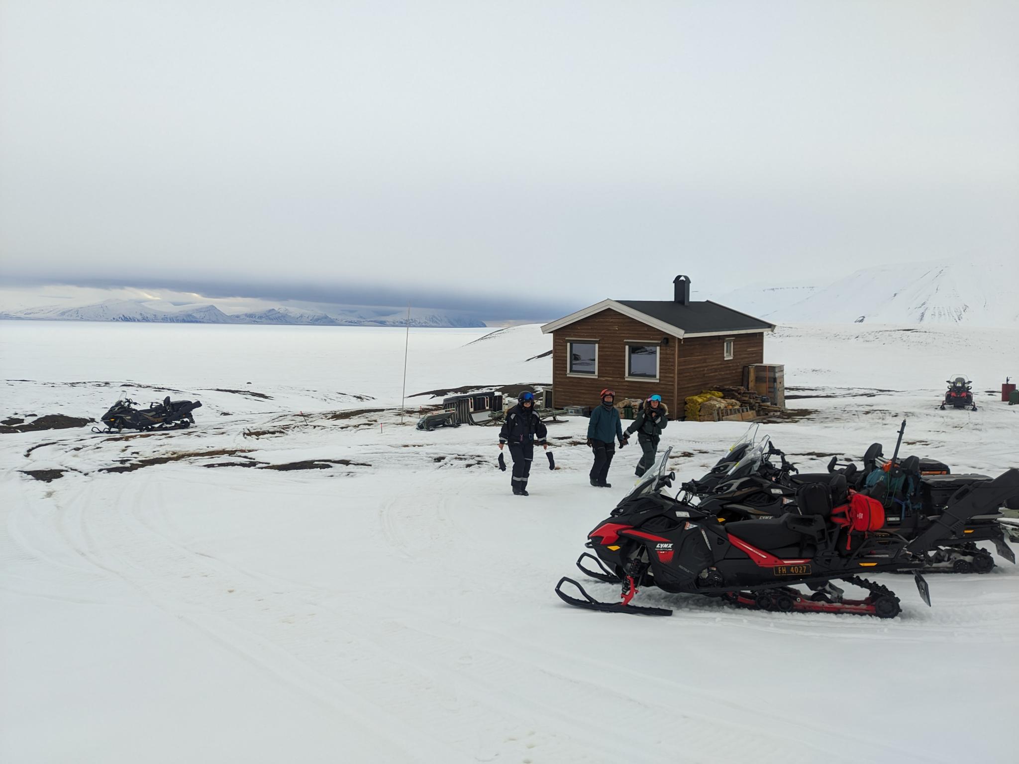
Figure 1: Part of the team and snow mobiles in front of Tarandus, a UNIS research cabin, with Van Mijenfjorden in the background. In summer, researchers stay at the cabin for months to acquire data in the surrounding valleys.
Such questions are what a team of EORC and UNIS researchers is trying to answer by combining extensive in situ sampling and UAV (drone) LiDAR and multispectral remote sensing campaigns. To match the small-scaled differences in the Arctic tundra, induced, for example, by effects of the micro topography on the suitability of a location for a plant to grow, we have been deriving spatially continuous snow and vegetation data, such as snow depth, plant species distribution and indicators for photosynthetic activity, at cm resolution using UAVs across different sites on Svalbard.
While previous campaigns had focused on testing methodological approaches to derive snow depth at such high resolutions while maintaining geospatial accuracy, and thus where conducted in the vicinity of the Longyearbyen settlement for better accessibility, our collaborative effort has been recently extended: As part of their current research stay on Svalbard, EORC postdocs Mirjana Bevanda and Jakob Schwalb-Willmann have visited a new joint research site in the remote valleys of Reindalen and Semmeldalen last week to acquire in situ and LiDAR data of the snow surface.
Organised by our collaboration partner Larissa Beumer (UNIS) and supported in the field by Ronja Seitz (UNIS field assistant and former EAGLE M.Sc. student), Aoibhin Murphy and Marlene Sehrbrock (both UNIS interns and current EAGLE M.Sc. students), PhD student Jonathan Fassora (UNIS), and department engineer & field technician Franka Leiterer (UNIS), the group headed out to the valleys of Semmeldalen and Reindalen via the Longyearbreen glacier – on snowmobiles with sledges attached to transport the equipment. Only in winter one can easily reach this remote, off-the-grid research site ca. 50 km south of Longyearbyen with heavy loads via land route. As soon as the snow is gone and the Tundra soil thaws, one has to hike – or take a long round trip using a boat to get there.
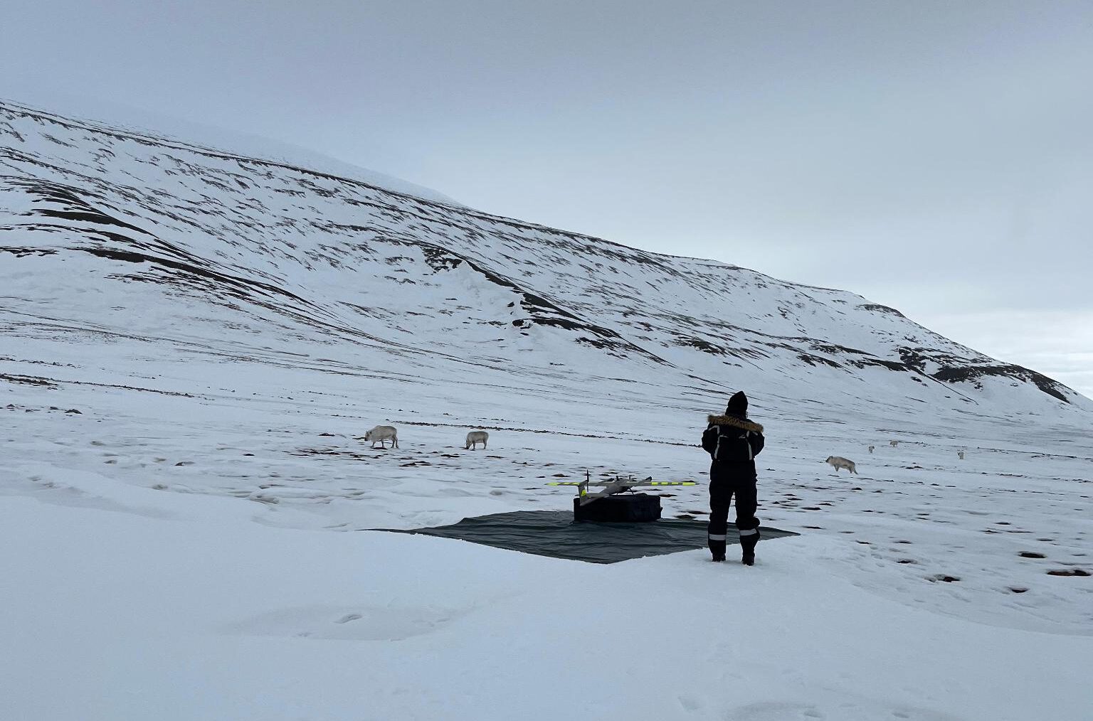
Figure 2: Reindeer grazing next to the UAV launch and landing site in Semmeldalen.
After arriving at the site, the group acquired LiDAR data of the snow surface using a fixed-wing, vertical takeoff and landing (VTOL) UAV, and conducted in situ snow measurements, surrounded by curious, grazing Reindeer. The Reindalen and Semmeldalen valleys are a place of particular research interest for us, as it is located in an area where continuous snow and biodiversity monitoring has been established for a long time. For example, in the framework of the Climate-ecological Observatory for Arctic Tundra (COAT) project, snow parameters have been collected throughout the winter for many years now, giving unique insights into snow evolution throughout and across seasons. In addition, as part of a project led by our collaboration partner Larissa Beumer, UNIS has been tracking reindeer movements in the area for several years using GPS collars. After UAV flights and in situ sampling were successfully completed at the first out of three areas of interest, the group had a safe trip back to Longyearbyen.
After the winter campaign in Reindalen and Semmeldalen is completed, we will be looking forward to the upcoming UAV vegetation mapping in summer throughout the growing season. These campaigns will be conducted by Ronja Seitz, who was recently awarded with an Arctic Field Grant for seasonal airborne mapping and modeling of Svalbard reindeer habitats in Reindalen. Her summer campaigns will give valuable insights into vegetation dynamics in relation to micro-topography and snow distribution in the previous winter. With the resulting spatially continuous, high resolution UAV data from both winter and summer, we want to contribute to a better understanding of the interaction between snow and vegetation, and its effect on reindeer habitats in the Svalbard tundra ecosystem.
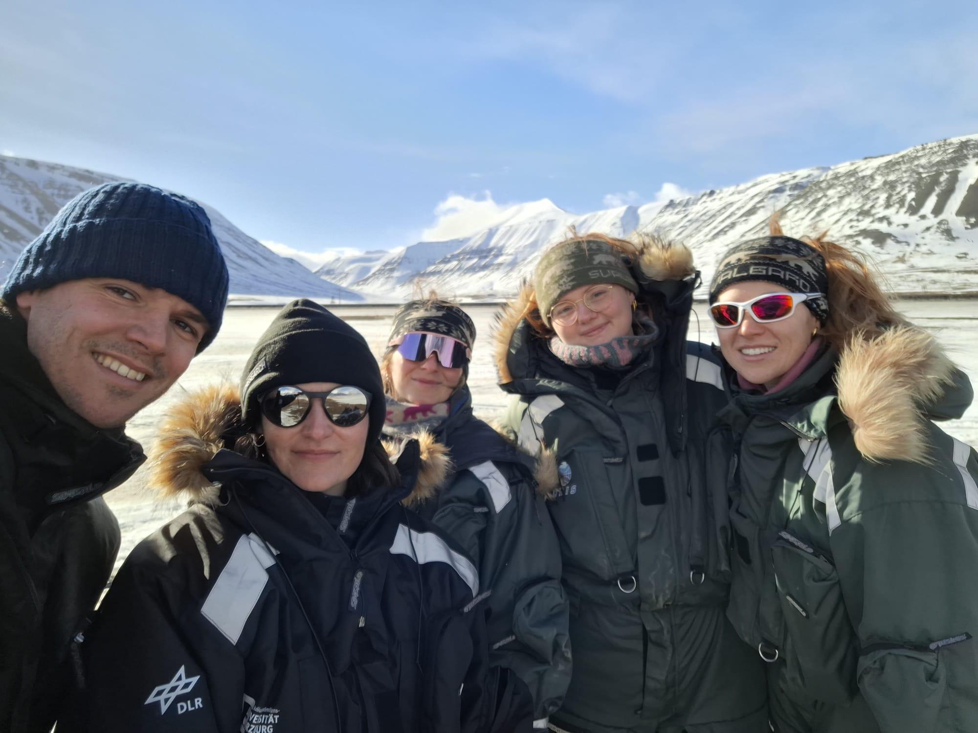
Figure 3: As every time, this year’s April UAV campaigns in Svallbard were a group effort (from right to left: Aoibhin Murphy, Marlene Sehbrock, Ronja Seitz, Mirjana Bevanda, and Jakob Schwalb-Willmann)


